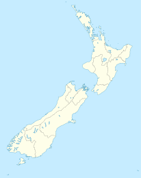
Waipapa Bay

Waipapa Bay

p1

Waipapa Bay
Waipapa Bay (Neuseeland)
Waipapa Bay
Koordinaten 42° 13′ S, 173° 52′ O-42.210972222222173.87083333333Koordinaten: 42° 13′ S, 173° 52′ O
Region Marlborough
Distrikt Kaikoura-Distrikt

Waipapa Bay ist eine kleine Ortschaft an der gleichnamigen Bucht in der Region Marlborough auf der Südinsel Neuseelands.

Der Ort liegt an der Küste des Pazifik am State Highway 1, 40 km nordöstlich von Kaikoura. Nachbarorte am Highway sind Clarence im Nordosten und Raukatara im Südwesten.[1]

Die Eisenbahnhauptstrecke Main North Line führt durch den Ort, hat hier aber keinen Haltepunkt.

Einzelnachweise

  1. New Zealand Travel Atlas, Wise Maps Auckland ISBN 0-908794-47-9 Karte 53

Wikimedia Foundation.

Игры ⚽ Поможем написать курсовую

Schlagen Sie auch in anderen Wörterbüchern nach:

  • Waipapa — bezeichnet in Neuseeland einen Ort in der Region Northland, siehe Waipapa (Northland) einen Ort in der Region Waikato, siehe Waipapa (Waikato) einen Ort in der Region Marlborough, siehe Waipapa Bay einen Fluss, siehe Waipapa River D …   Deutsch Wikipedia

  • Waipapa — is a small township in the Bay of Islands, of Northland New Zealand. It is around 10 minutes drive from Kerikeri,the nearest urban centre to Waipapa, located on State Highway 10. Waipapa its self is so small, having no supermarket or school, that …   Wikipedia

  • Waipapa (Northland) — p1 Waipapa …   Deutsch Wikipedia

  • Waipapa (canoe) — Infobox waka waka name =Waipapa (canoe) commander = priest = departed = landed =Doubtless Bay iwi = settled =NorthlandIn Māori tradition, Waipapa was one of the great ocean going, voyaging canoes that was used in the migrations that settled New… …   Wikipedia

  • Climbing areas of the North Island — This is a list of outdoor and indoor rock climbing areas in the North Island of New Zealand. Contents 1 Northland 2 Auckland 3 Waikato 3.1 Wharepapa South …   Wikipedia

  • North Island Climbing Areas — This is a list of Rock Climbing areas both indoors and outdoors on New Zealand s North Island. =Northland= *Apotu Road *Bald Rock *Mangaraho *Ngahere Drive *Rosvall Rockwall *Taratara *Ti Point *Tokatoka *Waipu Caves *Waipu Cove *Waro… …   Wikipedia

  • Clarence (Neuseeland) — p1 Clarence …   Deutsch Wikipedia

  • Raukatara — p1 Raukatara …   Deutsch Wikipedia

  • Catlins — The Catlins (manchmal auch The Catlins Coast) ist ein Gebiet im Südwesten der Südinsel Neuseelands zwischen Balclutha und Invercargill. Es streift die Grenze zwischen den Regionen Otago und Southland und umfasst auch den südlichsten Punkt der… …   Deutsch Wikipedia

  • The Catlins — (sometimes referred to as The Catlins Coast) comprises an area in the southeastern corner of the South Island of New Zealand. The area lies between Balclutha and Invercargill, straddling the boundary between the Otago and Southland regions. It… …   Wikipedia

Share the article and excerpts

Direct link
Do a right-click on the link above
and select “Copy Link”