Walbury Hill

Walbury Hill
Walbury Hill

Photo-request.svg

Bild gesucht 

BWf1

Höhe 297 m ASL
Lage Reading, England, Vereinigtes Königreich f3
Geographische Lage 51° 21′ 24″ N, 1° 28′ 21″ W51.356604-1.472397297Koordinaten: 51° 21′ 24″ N, 1° 28′ 21″ W
Walbury Hill (England)
Walbury Hill

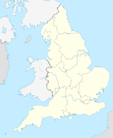
Walbury Hill 7 km südöstlich von Hungerford, Berkshire ist mit 297 m die höchste Erhebung in Süd-Ost England. Auf dem Hügel befinden sich die Überreste einer Befestigungsanlage aus der Eisenzeit.

Die BBC nutzt Walbury Hill bei Großereignissen für temporäre Sendemasten.

Galerie


Wikimedia Foundation.

Игры ⚽ Поможем написать курсовую

Schlagen Sie auch in anderen Wörterbüchern nach:

  • Walbury Hill — Infobox Mountain Name = Walbury Hill Photo = View from Walbury Hill.jpg Caption = The view from Walbury Hill, looking towards Combe Gibbet Elevation = 297 m (974 ft) Location = North Wessex Downs AONB, Berkshire, England Range = Prominence = c.… …   Wikipedia

  • List of hill forts in England — This List of hill forts in England is a list of links to any hill fort in England, UK.Berkshire*Alfred s Castle, Badbury Hill, Cherbury Camp, Hardwell Castle *Segsbury Camp, Uffington Castle, Walbury Hill, Wittenham ClumpsBristol*Kingsweston… …   Wikipedia

  • Leith Hill — Bild gesucht  BWf1 Höhe 294  …   Deutsch Wikipedia

  • Leith Hill — Infobox Mountain Name = Leith Hill Photo = Leith hill 07.jpg Caption = Elevation = 294 m (965 ft) Location = Surrey, England Range = Prominence = 249 m Parent peak = Dunkery Beacon Coordinates = coord |51.1757|… …   Wikipedia

  • Butser Hill — Infobox Mountain Name = Butser Hill Photo = Butser Hill.jpg Caption = Butser Hill from the base of the public Rights of way in England and Wales near the A3 road Elevation = 270 m (886 ft) Location = South Downs, England Range = Prominence = 158… …   Wikipedia

  • Milk Hill — Elevation 295 m (968 ft) Prominence 148 m (486 ft) …   Wikipedia

  • Inkpen — is a village and civil parish in the English county of Berkshire. It is situated in the south west of the county, close to the Wiltshire and Hampshire border. It is located at gbmapping|SU367642.Amenities and landmarksThere are no shops in Inkpen …   Wikipedia

  • Test Way — Infobox Hiking trail Name=Test Way Photo=Combe Gibbet views east.jpg Caption=The Test Way near Combe Gibbet, Berkshire Location=England Designation= Length=Convert|49|mi|0 Start/End Points=Walbury Hill in West Berkshire Eling in Hampshire… …   Wikipedia

  • Wayfarers Walk — Infobox Hiking trail Name=Wayfarers Walk Photo=Wayfarers walk marker.jpg Caption=Wayfarers Walk waymarker Location=England Designation= Length=Convert|70|mi|0 Start/End Points=Walbury Hill in West Berkshire Emsworth in Hampshire Use=Hiking… …   Wikipedia

  • North Wessex Downs — Coordinates: 51°10′19″N 1°49′30″W / 51.172°N 1.825°W / 51.172; 1.825 …   Wikipedia

Share the article and excerpts

Direct link
Do a right-click on the link above
and select “Copy Link”