West Redonda Island

West Redonda Island

Vorlage:Infobox Insel/Wartung/Fläche fehltVorlage:Infobox Insel/Wartung/Höhe fehlt

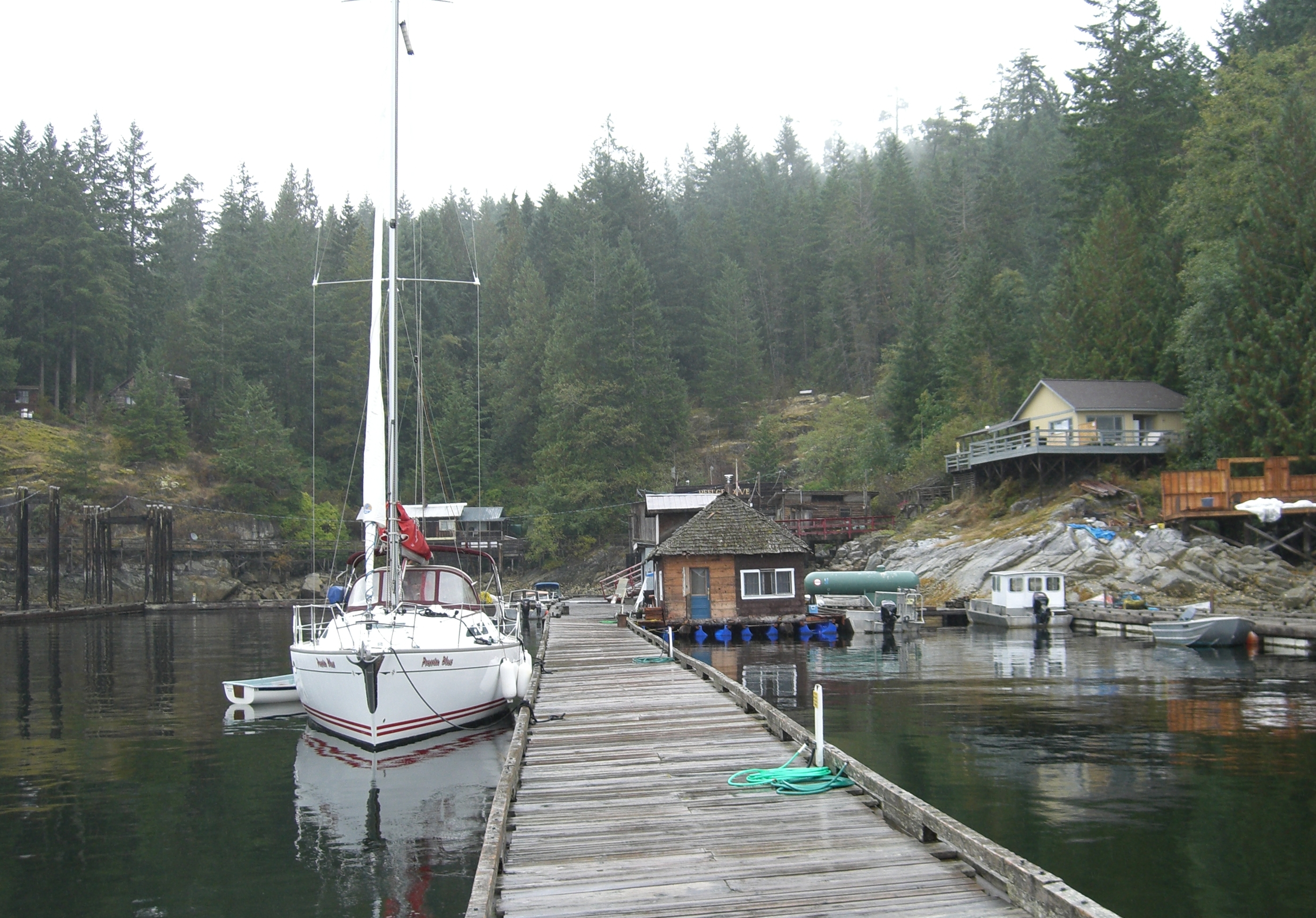
West Redonda Island
Refuge Cove im Süden der Insel
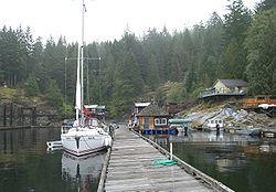
Gewässer Pazifischer Ozean
Inselgruppe Discovery Islands
Geographische Lage 50° 13′ 0″ N, 124° 53′ 0″ W50.216666666667-124.88333333333Koordinaten: 50° 13′ 0″ N, 124° 53′ 0″ W
Lage von West Redonda Island

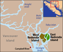
West Redonda Island ist eine Insel in British Columbia in Kanada. Sie zählt zu den Discovery Islands.

Deer Passage → Raza Island Pryce ChannelFestland Toba Inlet
Cortes Island Nachbargemeinden Waddington ChannelEast Redonda Island
Lewis Channel → Cortes Island Desolation Sound Desolation Sound

Im Westen der Insel befindet sich die Bucht Teakerne Arm, die vom Lewis Channel abzweigt.

Geschichte

Die Insel wurde 1792 während einer Expedition von Dionisio Alcalá Galiano und Cayetano Valdés y Flores entdeckt. Sie nannten sie Isla Redonda, was übersetzt Runde Insel heißt. Dabei errichten sie eine Basis im Westen der Insel und erkunden mit mehreren kleineren Booten die anderen Inseln.

Weblinks


Wikimedia Foundation.

Игры ⚽ Нужно решить контрольную?

Schlagen Sie auch in anderen Wörterbüchern nach:

  • West Redonda Island — is an island in British Columbia, Canada. It is part of the Discovery Islands, an archipelago between Vancouver Island and the mainland, and between the Strait of Georgia and Johnstone Strait.West Redonda Island is located west of East Redonda… …   Wikipedia

  • East Redonda Island — is a coastal island in British Columbia, Canada, part of the Discovery Islands archipelago. It lies just to the north of DesolationSound Marine Park, in the Strathcona Regional District.This island is separated from the larger West Redonda Island …   Wikipedia

  • East Redonda Island — Vorlage:Infobox Insel/Wartung/Bild fehltVorlage:Infobox Insel/Wartung/Fläche fehlt East Redonda Island Gewässer Pazifischer Ozean Inselgruppe Discovery Islands Geographische Lage …   Deutsch Wikipedia

  • Redonda Bay, British Columbia — Redonda Bay is an uninhabited locality that was the site of a cannery owned by Francis Millerd Co., located on the northwest side of West Redonda Island in the Discovery Islands of the South Coast of British Columbia, Canada.ee also*List of… …   Wikipedia

  • Redonda — is a very small, uninhabited Caribbean island or islet which is politically a part of the nation of Antigua and Barbuda [ [http://www.ab.gov.ag Government of Antigua and Barbuda Constitution] ] , in the Leeward Islands, West Indies. This small… …   Wikipedia

  • Cortes Island — is located at the northern end of the Strait of Georgia. Geography Location Strait of Georgia Coordinates …   Wikipedia

  • Maurelle Island — is located in the middle of the Discovery Islands. Geography Location British Columbia Coordinates …   Wikipedia

  • Cortes Island (British Columbia) — Cortes Island is one of the series of Discovery Islands in British Columbia, Canada. It is separated from Quadra Island by Sutil Channel, and from West Redonda Island by Lewis Channel. Desolation Sound lies to the east of Cortes Island.Cortes… …   Wikipedia

  • Redonda Mesa — is a tall mesa located in an unincorporated area of southwestern Riverside County, California near the Pacific Ocean, located in the Southern Santa Ana Mountains. It stands up at 2,825 feet above sea level.DescriptionThe mesa lies almost right on …   Wikipedia

  • West Kildonan, Winnipeg — West Kildonan is a residential suburb of Winnipeg, Manitoba, lying on the west side of the Red River, and immediately north of the old City of Winnipeg in the north central part of the city. It is bounded by the Red River on the east, the north… …   Wikipedia

Share the article and excerpts

Direct link
Do a right-click on the link above
and select “Copy Link”