Williams River (New South Wales)
- Williams River (New South Wales)
-
| Williams River |
|
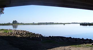
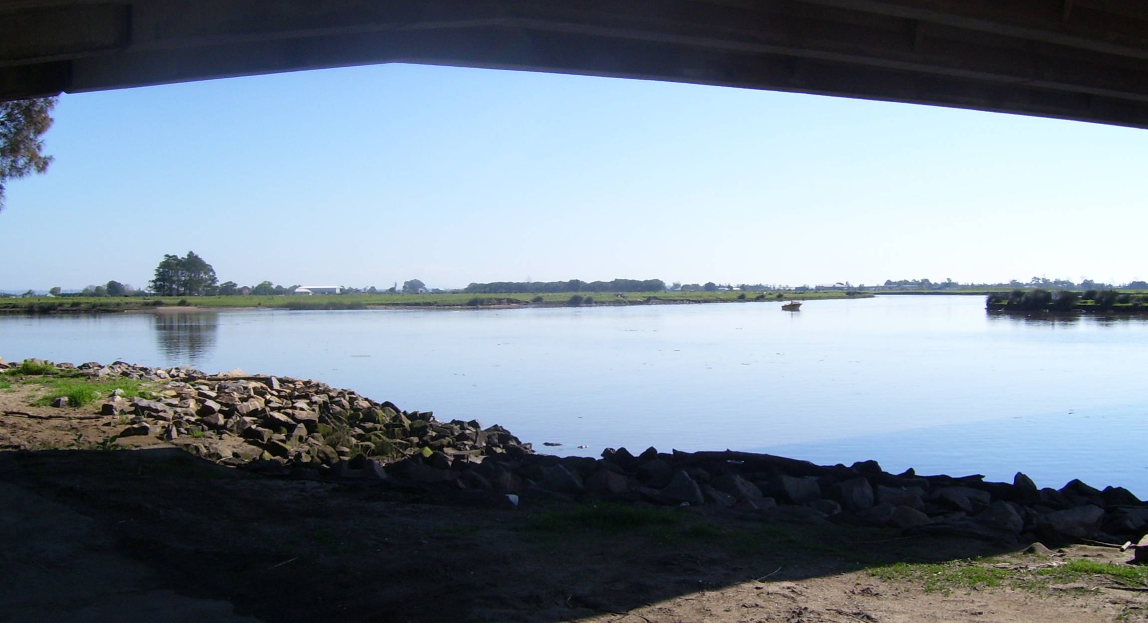
Einmündung des Williams River in den Hunter River bei Raymond TerraceVorlage:Infobox Fluss/KARTE_fehlt
|
| DatenVorlage:Infobox Fluss/GKZ_fehlt |
| Lage |
New South Wales (Australien) |
| Flusssystem |
Hunter River (New South Wales) |
| Abfluss über |
Hunter River → Tasmansee |
| Quelle |
Careys Peak (Barrington-Tops-Nationalpark)
32° 11′ 47″ S, 151° 33′ 5″ O-32.196388888889151.55138888889747 |
| Quellhöhe |
747 mVorlage:Infobox Fluss/HÖHENBEZUG-QUELLE_fehlt[1] |
| Mündung |
Hunter River bei Raymond Terrace
-32.754722222222151.743888888891
32° 45′ 17″ S, 151° 44′ 38″ O-32.754722222222151.743888888891 |
| Mündungshöhe |
1 mVorlage:Infobox Fluss/HÖHENBEZUG-MÜNDUNG fehlt[1] |
| Höhenunterschied |
746 m |
| Länge |
142 km[1]Vorlage:Infobox Fluss/EINZUGSGEBIET_fehlt
Vorlage:Infobox Fluss/ABFLUSS_fehlt
|
| Rechte Nebenflüsse |
Myall Creek, Tabbil Creek, Wallarobba Creek, Unwarrabin Creek |
| Linke Nebenflüsse |
Chichester River, Carawiry Creek, Black Camp Creek, Chambers Creek, Tumbledown Creek, Stony Creek |
| Mittelstädte |
Dungog, Raymond Terrace |
| Kleinstädte |
Salisbury, Brandon Grove, Fosterton, Brookfield, Clarence Town, Seaham |
| Gemeinden |
Barrington House |
Der Williams River ist ein Fluss im Osten des australischen Bundesstaates New South Wales. Er entspringt am Barrington House im Barrington-Tops-Nationalpark und fließt nach Südosten und Süden, wo er genau westlich der Fitzgerald Bridge in Raymond Terrace auf den Hunter River trifft. Auf seinem Weg durchfließt er die Städte Salisbury, Bandon Grove, Fosterton, Dungog, Brookfield, Clarence Town und Seaham.[2]
Früher hieß der Williams River auch Dorribang River.[2]
Nebenflüsse[1] mit Mündungshöhen
- Chichester River – 82 m
- Carawiry Creek – 58 m
- Myall Creek – 51 m
- Tabbil Creek – 45 m
- Wallarobba Creek – 36 m
- Black Camp Creek – 22 m
- Unwarrabin Creek – 21 m
- Chambers Creek – 6 m
- Tumbledown Creek – 4 m
- Stony Creek – 4 m
Einzelnachweise
- ↑ a b c d Map of Williams River, NSW. Bonzle.com
- ↑ a b Geographical Names Register Extract: Williams River. Geographical Names Register (GNR) of NSW. Geographical Names Board of New South Wales.
Kategorien:
- Flusssystem Hunter River (New South Wales)
- Fluss in New South Wales
- Fluss in Australien und Ozeanien
Wikimedia Foundation.
Schlagen Sie auch in anderen Wörterbüchern nach:
Hunter River (New South Wales) — Hunter River Schiff an der Mündung des Hunter River bei NewcastleVorlage:Infobox Fluss/KARTE fehlt … Deutsch Wikipedia
New Lambton, New South Wales — New Lambton Newcastle, New South Wales Population: 9236 (2006 census) Postcode: 2305 Area: 5.2 km² (2.0 … Wikipedia
Hunter River (New South Wales) — and winter maxima around .Except for the driest parts of Tasmania and a small area of the Monaro between Cooma and Nimmitabel, the Hunter Valley is the southern limit of rich black earths (actually black cracking clays). These are the only soils… … Wikipedia
New South Wales state election, 1953 — 1950 ← 14 February 1953 (1953 02 14) … Wikipedia
Rivers of New South Wales — Thunderbolts Way and the bridge over the Little Manning River. This page discusses the rivers and hydrography of the State of New South Wales, Australia. The principal topographic feature of New South Wales is the series of low highlands and… … Wikipedia
New South Wales Premier's Literary Awards — The New South Wales Premier s Literary Awards were established in 1979 by the New South Wales Premier Neville Wran. Commenting on its purpose, Wran said: We want the arts to take, and be seen to take, their proper place in our social priorities.… … Wikipedia
New South Wales Legislative Assembly electoral districts — The New South Wales Legislative Assembly is elected from 93 single member electorates called districts. Current districts This is a list of districts for the 2007 general election.* Albury * Auburn * Ballina * Balmain (1880 1894: Balmain; 1894… … Wikipedia
Williams River — ist der Name mehrerer Flüsse: Australien Williams River (New South Wales), ein Nebenfluss des Hunter River (New South Wales) Williams River (Queensland), ein Nebenfluss des Gilliat River Williams River (Western Australia), ein Nebenfluss des… … Deutsch Wikipedia
Williams River — may refer to any of several rivers:Australia * Williams River (New South Wales) * Williams River (Queensland) * Williams River (Western Australia)United States * Williams River (Vermont) * Williams River (West Virginia) * Bill Williams River, in… … Wikipedia
Nelsons Plains, New South Wales — Nelsons Plains New South Wales Flooding at Nelsons Plains in 2007 Postco … Wikipedia