Zrębin

Zrębin
Zrębin
Coats of arms of None.svg
Zrębin (Polen)
Zrębin
Zrębin
Basisdaten
Staat: Polen
Woiwodschaft: Heiligkreuz
Landkreis: Staszowski
Gmina: Połaniec
Geographische Lage: 50° 27′ N, 21° 14′ O50.44166666666721.240277777778Koordinaten: 50° 26′ 30″ N, 21° 14′ 25″ O
Höhe: 158 m n.p.m
Einwohner:
Postleitzahl: 28-230
Telefonvorwahl: (+48) 15
Kfz-Kennzeichen: TSZ
Wirtschaft und Verkehr
Nächster int. Flughafen: Johannes Paul II. Krakau-Balice

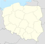
Zrębin ist ein Dorf in Polen in der Gemeinde Połaniec im Powiat Staszowski. Es liegt auf einer Höhe von etwa 158 Metern über dem Meeresspiegel in der Woiwodschaft Heiligkreuz. Das Verwaltungszentrum der Gemeinde in Połaniec ist etwa drei Kilometer in östlicher Richtung von Zrębin entfernt. Haupteinnahmequelle des Dorfes ist die Landwirtschaft.

Weblinks


Wikimedia Foundation.

Игры ⚽ Нужен реферат?

Schlagen Sie auch in anderen Wörterbüchern nach:

  • Zrębin — Infobox Settlement name = Zrębin settlement type = Village total type = image shield = subdivision type = Country subdivision name = POL subdivision type1 = Voivodeship subdivision name1 = Świętokrzyskie subdivision type2 = County subdivision… …   Wikipedia

  • Gmina Połaniec — Infobox Settlement name = Gmina Połaniec other name = Połaniec Commune settlement type = Gmina total type = Total image shield = POL gmina Połaniec COA.svg subdivision type = Country subdivision name = POL subdivision type1 = Voivodeship… …   Wikipedia

  • Maśnik —   Village   …   Wikipedia

  • Okrągła —   Village   …   Wikipedia

  • Polaniec — Połaniec …   Deutsch Wikipedia

  • Połaniec — Połaniec …   Deutsch Wikipedia

Share the article and excerpts

Direct link
Do a right-click on the link above
and select “Copy Link”