Coonabarabran

Coonabarabran
Coonabarabran
Staat: Australien Australien
Bundesstaat: Flag of New South Wales.svg New South Wales
Koordinaten: 31° 15′ S, 149° 16′ O-31.25149.26666666667505Koordinaten: 31° 15′ S, 149° 16′ O
Höhe: 505 m
 
Einwohner: 2.609 (2006 [1])
 
Zeitzone: AEST (UTC+10)
Postleitzahl: 2357
LGA: Warrumbungle Shire Council
Coonabarabran (Australien)
Coonabarabran
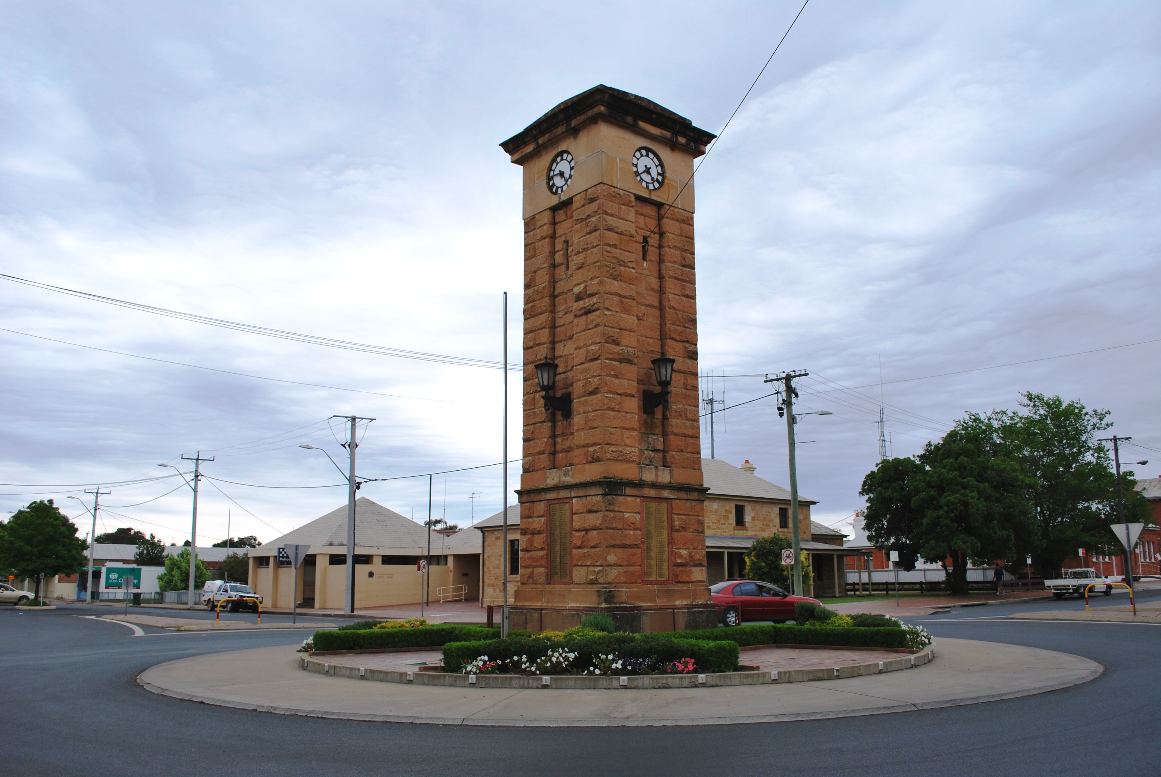
Coonabarabran
Kriegerdenkmal auf der Hauptstraße

Coonabarabran ist eine Stadt in New South Wales in Australien mit 2.609 Einwohnern. Sie liegt 451 km nordwestlich von Sydney am Newell Highway und Oxley Highway. Sie ist der Verwaltungssitz des Warrumbungle Shire.

Lewis Gordon gründete Coonabarabran im Jahre 1859. Das Gebiet war bereits durch eine Regierungsexpediton 1817 erschlossen worden und die Aboriginal, die Kamilaroi, lebten bereits seit 7.500 Jahren in diesem Gebiet. Coonabarabran bildet das Tor zum Warrumbungle-Nationalpark und zu dem Pilliga Forest und es führt ein Touristenbüro. Im Ort gibt es Motels, Hotels, Restaurants und Caravanparks. Ferner gibt es eine Mineraliensammlung, das Crystal Kingdom, und einen Golfclub.

Bei Coonabarabran befindet sich ein Sternenobservatorium mit einem Teleskop von 3,9 Metern Durchmesser, das größte Teleskop Australiens, das Siding Spring Observatorium auf dem Siding Spring Mountain im Warrumbungle-Nationalpark. Für Astronomiestudenten und Astrophysikern der Australian National University gibt es 12 Teleskope im Gebäude auf dem Siding Spring Mountain.

Weblinks

 Commons: Coonabarabran – Sammlung von Bildern, Videos und Audiodateien

Stadtplan von Coonabarabran

Einzelnachweise

  1. Australian Bureau of Statistics (25. Oktober 2007): Coonabarabran (Urban Centre/Locality) (Englisch). 2006 Census QuickStats. Abgerufen am 17. April 2009.

Wikimedia Foundation.

Игры ⚽ Поможем решить контрольную работу

Schlagen Sie auch in anderen Wörterbüchern nach:

  • Coonabarabran — La grand rue de Coonabarabran Administration Pays …   Wikipédia en Français

  • Coonabarabran — Original name in latin Coonabarabran Name in other language COJ, Coonabarabran, Coonabarrabran State code AU Continent/City Australia/Sydney longitude 31.27734 latitude 149.27904 altitude 518 Population 2736 Date 2012 02 28 …   Cities with a population over 1000 database

  • Coonabarabran — ▪ New South Wales, Australia       town, east central New South Wales, Australia. It lies along the Castlereagh River, near the Pilliga Scrub district. Surveyed in 1859 and gazetted a shire in 1906, it derived its name from an Aboriginal word… …   Universalium

  • Coonabarabran, New South Wales — Coonabarabran New South Wales Town centre …   Wikipedia

  • Coonabarabran Airport — IATA: COJ – ICAO: YCBB Summary Airport type Public Location Coonabarabran, New South Wales Elevation  …   Wikipedia

  • Coonabarabran — /kunəˈbærəbrən/ (say koohnuh baruhbruhn) noun a town in north eastern NSW; pastoral and agricultural centre. {Australian Aboriginal; ? Kamilaroi} …  

  • 2618 Coonabarabran — Infobox Planet minorplanet = yes width = 25em bgcolour = #FFFFC0 apsis = name = Coonabarabran symbol = caption = discovery = yes discovery ref = discoverer = Helin, E. F. and Bus, S. J. discovery site = Siding Spring discovered = June 25, 1979… …   Wikipedia

  • COJ — Coonabarabran, New South Wales, Australia (Regional » Airport Codes) …   Abbreviations dictionary

  • COJ — Coonabarabran, Australia internationale Flughafen Kennung …   Acronyms

  • COJ — Coonabarabran, Australia internationale Fughafen Kennung …   Acronyms von A bis Z

Share the article and excerpts

Direct link
Do a right-click on the link above
and select “Copy Link”