- Dwarfie Stane
-
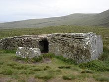 Zugang zum Dwarfie Stane.
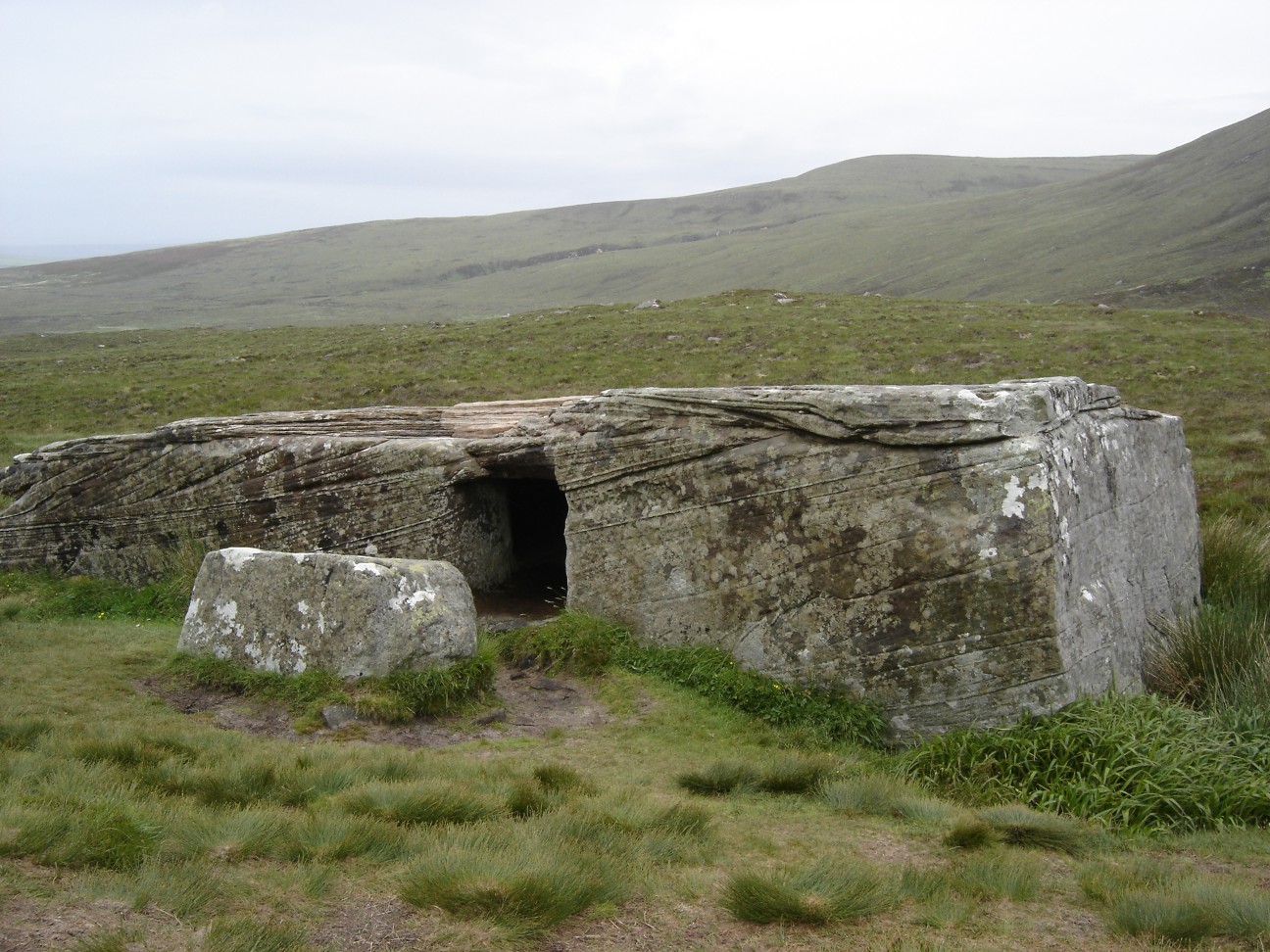
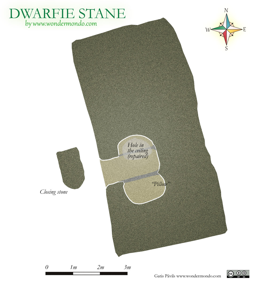
 Grundplan der Aushöhlung
Das etwa 5000 Jahre alte Felsgrab Dwarfie Stane (Zwergenstein) liegt in einem Tal zwischen Quoys und Rackwick auf der Orkney Insel Hoy. Es das einzige allgemein anerkannte Beispiel eines Felsgrabes in Großbritannien und zugleich das nördlichste in Europa.
Der Dwarfie Stane ist ein etwa 8,5 m langer und 2,5 m breiter Block aus rotem Sandstein, der sich aus der naheliegenden Felswand gelöst hat. Andererseits deutet die Anwesenheit des Partick Stane eines ähnlichen Felsblocks ca. 200 Meter entfernt darauf hin, dass beide Steine beim Rückzug der Gletscher, am Ende der letzten Eiszeit, hierhin verschleppt wurden.
Die quer liegende kleine Kammer mit dem mittig auftreffenden kurzen Gang wurde zwischen dem Neolithikum und der frühen Bronzezeit in den Stein gepickt. Eine quadratische Öffnung von 0,9 x 0,9 m führt in die Kammer. Bemerkenswert ist die Tatsache, dass der massive Stein mit Werkzeugen aus Stein ausgehöhlt wurde. Vor dem Eingang liegt ein Sandstein-Block, der als Verschlussstein der Kammer angesehen wird, die bis ins 16. Jahrhundert ungeöffnet gewesen sein soll. Es gibt keine Aufzeichnungen über irgendwelche archäologischen Ausgrabungen oder Funde.
Inhaltsverzeichnis
Legende
Laut einer alten orkadischen Fabel ist der Dwarfie Stane die Arbeit eines Riesen und seiner Frau. Ein dritter Riese sperrte das „gigantische Paar“ in den Stein. Aber seine Pläne wurden dadurch vereitelt, dass die inhaftierten Riesen ein Loch in die Decke der Kammer stemmten. Diese Legende erklärt das heute mit Beton verfüllte Loch im Dach der Kammer.
Siehe auch
Literatur
- Anna Ritchie, Graham Ritchie: Scotland. Archaeology and Early History. Thames and Hudson Ltd., London 1981, ISBN 0-50002-100-7, (Ancient places and people 99).
Weblinks
 Commons: Dwarfie Stane – Sammlung von Bildern, Videos und Audiodateien
- Dwarfie Stane (englisch)
58.884451-3.314303Koordinaten: 58° 53′ 4″ N, 3° 18′ 51″ WKategorien:- Archäologischer Fundplatz auf den Orkneyinseln
- Grabbau
- Höhlenbauwerk
Wikimedia Foundation.