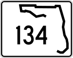
Florida State Road 134 — Infobox road state=FL type= route=134 length mi= length km= established= direction a=West direction b=East starting terminus= Normandy Blvd SR 228 in Jacksonville ending terminus= Roosevelt Blvd U.S. Route 17 State Road 15 previous route=129 next … Wikipedia
Florida State Road 15 — FL 15 redirects here. For the congressional district, see Florida s 15th congressional district. State Road 15 Route information Maintained by FDOT … Wikipedia
Florida State Road 228 — Basisdaten Gesamtlänge: 26 mi/42 km Eröffnung: 1945 Bundesstaat: … Deutsch Wikipedia
Florida State Road 23 — Infobox road state=FL type= route=23 length mi=15.1 length round=2 length ref=cite web |url=http://www.dot.state.fl.us/planning/statistics/gis/default.htm |title=FDOT GIS data |accessmonthday=June 25 |accessyear=2007 |author=Florida Department of … Wikipedia
Florida State Road 129 — Infobox road state=FL type= route=129 alternate name= Mc Duff Ave length mi= length km= established= direction a= South direction b= North starting terminus= ending terminus= Commonwealth Ave., in Jacksonville previous route=128 next route=134 Mc … Wikipedia
List of highways numbered 134 — The following highways are numbered 134: Contents 1 Canada 2 India 2.1 Tamilnadu 3 Japan 4 United States … Wikipedia
Florida — This article is about the U.S. state of Florida. For other uses, see Florida (disambiguation). State of Florida … Wikipedia
State highways in Colorado — The standard Colorado state highway sign. The top half is the flag of Colorado. Highway names Interstates: Interstate X (I X) US Routes: U.S. Highway X (US X) … Wikipedia
Orlando, Florida — Orlando redirects here. For other uses, see Orlando (disambiguation). Orlando City City of Orlando … Wikipedia
County Road 213 (Duval County, Florida) — County Road 213, formerly State Road 213, [United States Geological Survey, [http://www.terraserver usa.com/image.aspx?T=2 S=14 Z=17 X=133 Y=1046 W=3 1980 topographic map] ] and locally known as the Old MiddleBurg Rd for much of its route, runs… … Wikipedia
 FL 228 bei Jacksonville
 US 17 in Jacksonville