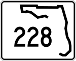
Florida State Road 228

Florida State Road 228
Straßenschild der Florida State Route 228
Basisdaten
Gesamtlänge:  26 mi/42 km
Eröffnung:  1945
Bundesstaat:  Florida
Anfangspunkt:  US 90 in Macclenny
Endpunkt:  Jacksonville

Die Florida State Route 228 (kurz FL 228) ist eine State Route im US-Bundesstaat Florida, die in Ost-West-Richtung verläuft.

Die State Route beginnt am U.S. Highway 90 in Macclenny und endet nach 42 Kilometern im Zentrum von Jacksonville.

Verlauf

Ab Macclenny verläuft die State Route zunächst in südöstlicher Richtung und trifft im Südosten der Stadt auf die Interstate 10 sowie in Maxville auf den U.S. Highway 301 und die Florida State Route 200. Die Straße führt danach in Richtung Osten und passiert im Südosten den Cecil Field Airport. Kurz darauf zweigt die State Route 134 ab.

Auf dem Stadtgebiet von Jacksonville passiert die FL 228 anschließend den Herlong Airport und trifft kurz darauf auf die Interstate 295 sowie auf die Florida State Routes 103 und 111. Ab der Kreuzung mit dem U.S. Highway 17 nutzen sie eine gemeinsame Trasse, die etwa ein Kilometer nördlich in die Interstate 10 übergeht. Nach dem Ende der I-10 nutzen sie die Interstate 95 in Richtung Norden. An der Exit 353 verlassen sie die Interstate und verlaufen zusammen mit dem U.S. Highway 23 in Richtung Osten. Die FL 228 endet anschließend im Zentrum von Jacksonville.

Siehe auch


Wikimedia Foundation.

Игры ⚽ Нужно сделать НИР?

Schlagen Sie auch in anderen Wörterbüchern nach:

  • Florida State Road 228 — State Road 228 Route information Maintained by FDOT Length: 26 mi[1] …   Wikipedia

  • Florida State Road 15 — FL 15 redirects here. For the congressional district, see Florida s 15th congressional district. State Road 15 Route information Maintained by FDOT …   Wikipedia

  • Florida State Road 13 — FL 13 redirects here. For the congressional district, see Florida s 13th congressional district. State Road 13 Route information Maintained by FDOT L …   Wikipedia

  • Florida State Road 134 — Infobox road state=FL type= route=134 length mi= length km= established= direction a=West direction b=East starting terminus= Normandy Blvd SR 228 in Jacksonville ending terminus= Roosevelt Blvd U.S. Route 17 State Road 15 previous route=129 next …   Wikipedia

  • Florida State Road 134 — Basisdaten Gesamtlänge:  11 mi/18 km Bundesstaat:  Florida …   Deutsch Wikipedia

  • Florida State Road 13 — Basisdaten Gesamtlänge:  28 mi/45 km Eröffnung:  1945 Bundesstaat:  …   Deutsch Wikipedia

  • Florida State Road 126 — Infobox FL State Road type=state route=126 length mi=2.37 [http://www.dot.state.fl.us/planning/statistics/gis/default.htm FDOT GIS data] ] length km=3.82 formed= dir1=West dir2=East from= junction= in Jacksonville to= in Jacksonville previous… …   Wikipedia

  • Florida State Road 129 — Infobox road state=FL type= route=129 alternate name= Mc Duff Ave length mi= length km= established= direction a= South direction b= North starting terminus= ending terminus= Commonwealth Ave., in Jacksonville previous route=128 next route=134 Mc …   Wikipedia

  • Florida State Road 121 — State Road 121 is a major state highway that runs north and south in northern Florida. The road is actually part of a long multi state route that also goes through Georgia and South Carolina. Some see it as a de facto auxiliary route from U.S.… …   Wikipedia

  • Florida State Road 211 — Infobox road state=FL type= route=211 length mi= length km= established= direction a=South direction b=North starting terminus= Roosevelt Blvd ending terminus= (Acosta Bridge) , continuing into downtown Jacksonville along Riverside Ave . previous …   Wikipedia

Share the article and excerpts

Direct link
Do a right-click on the link above
and select “Copy Link”