- Franklin (Tennessee)
-
Franklin 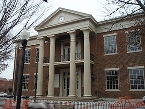
Williamson County CourthouseLage in Tennessee 
Basisdaten Staat: Vereinigte Staaten Bundesstaat: Tennessee County: Koordinaten: 35° 56′ N, 86° 51′ W35.929166666667-86.8575196Koordinaten: 35° 56′ N, 86° 51′ W Zeitzone: Central Standard Time (UTC−6) Einwohner: 62.487 (Stand: 2010) Bevölkerungsdichte: 803,2 Einwohner je km² Fläche: 78,0 km² (ca. 30 mi²)
davon 77,8 km² (ca. 30 mi²) LandHöhe: 196 m Vorwahl: +1 615 FIPS: 47-27740 GNIS-ID: 1284816 Webpräsenz: www.franklin-gov.com Bürgermeister: John Schroer Franklin ist eine Stadt und der Sitz der Countyverwaltung (County Seat) des Williamson County im US-Bundesstaat Tennessee. Die Stadt ist ein Vorort von Nashville und grenzt im Osten an die Interstate 65 und im Süden, Westen und Norden hauptsächlich an agrarwirtschaftlich genutztes Land.
Inhaltsverzeichnis
Geschichte
Franklin wurde am 26. Oktober 1799 gegründet und nach Benjamin Franklin benannt. In der Zeit vor dem Amerikanischen Bürgerkrieg war Franklin das Zentrum der Plantagenwirtschaft in Tennessee.
Am 30. November 1864 kam es im amerikanischen Bürgerkrieg zur Schlacht von Franklin, bei der es mehr als 8000 Opfer gab.
Heute zählt Franklin zu einer der wohlhabendsten Städte in Tennessee.
Demographische Daten
Bei einer Volkszählung im Jahr 2000 wurde 41.842 Einwohner gezählt, davon wurden 48,3 % als männliche und 51,7 % weibliche Einwohner ausgemacht. Das Durchschnittsalter liegt bei 33,0 Jahren.
Söhne und Töchter
- Luke Benward, Schauspieler
- John P. Buchanan, Politiker und der 28. Gouverneur von Tennessee
- Sam McGee, Gitarrist und Banjo-Spieler
- Benjamin D. Nabers, Politiker, Mitglied im US-Repräsentantenhaus
- Paramore, Alternative Rock Band
- James Storm, Wrestler
- Taylor Ware, Sängerin
- Alexander White, Rechtsanwalt, Richter und Politiker
- John Wilkins Whitfield, Armeeoffizier und Politiker, Mitglied im US-Repräsentantenhaus
Quellen
Kategorien:- Ort in Tennessee
- County Seat in Tennessee

Wikimedia Foundation.