Gods Lake

Gods Lake
Gods Lake

Photo-request.svg

Bild gesucht 

BW

Geographische Lage Manitoba (Kanada)
Abfluss Gods River
Orte am Ufer Gods Lake Narrows, Gods River
Daten
Koordinaten 54° 40′ N, 94° 15′ W54.673055555556-94.246944444444181Koordinaten: 54° 40′ N, 94° 15′ W
Gods Lake (Manitoba)
Gods Lake
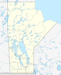
Höhe über Meeresspiegel 181 m
Fläche 1.061 km²f5
Länge 80 kmf6
Breite 45 kmf7

Der Gods Lake ist ein See in der kanadischen Provinz Manitoba. Er liegt 250 km nordöstlich des Winnipegsees sowie 400 km südwestlich der Hudson Bay und hat eine Länge von 80 km in ostwestlicher und eine Breite von 45 km in nordsüdlicher Richtung mit einer Fläche von 1.061 km²[1] und ist damit etwas doppelt so groß wie der Bodensee. Im See befinden sich zahlreiche Inseln, die größte von ihnen, Elk Island, ist etwa 20 km lang und beherbergt selbst wieder kleinere Seen. Zwei indianische Gemeinden mit je einem kleinen Flugplatz liegen am See, Gods Lake Narrows im Südwesten und Gods River im Nordosten.

Fußnoten

  1. Der Gods Lake bei Natural Resources Canada

Wikimedia Foundation.

Игры ⚽ Нужно решить контрольную?

Schlagen Sie auch in anderen Wörterbüchern nach:

  • Gods Lake — Infobox lake lake name = Gods Lake image lake = caption lake = image bathymetry = caption bathymetry = location = Northeastern Manitoba coords = coord|54|40|N|94|20|W|region:CA type:waterbody|display=inline,title type = inflow = outflow = Gods… …   Wikipedia

  • Gods Lake — Sp Dievų ẽžeras Ap Gods Lake L Kanadoje (Manitoba) …   Pasaulio vietovardžiai. Internetinė duomenų bazė

  • Gods Lake Narrows, Manitoba — Gods Lake Narrows is a community located in northeastern Manitoba in Canada. The community is located on the shores of Gods Lake, which is the 7th largest lake in the province. It is believed to have a depth of over 500 feet which makes it the… …   Wikipedia

  • Gods Lake Narrows Airport — Infobox Airport name = Gods Lake Narrows Airport IATA = YGO ICAO = CYGO type = Public owner = operator = Government of Manitoba city served = location = Gods Lake Narrows, Manitoba elevation f = 617 elevation m = 188 coordinates =… …   Wikipedia

  • Gods Lake Narrows Water Aerodrome — is located adjacent to Gods Lake Narrows, Manitoba, Canada.ee also*Gods Lake Narrows AirportReferences …   Wikipedia

  • Gods Lake Airport — is located convert|0.5|NM|abbr=on|lk=in east of Gods Lake, Manitoba, Canada.References …   Wikipedia

  • Gods Lake Indian Reservation — Sp Dievų ẽžero indėnų rezervãcija Ap Gods Lake Indian Reservation L Kanadoje (Manitoba) …   Pasaulio vietovardžiai. Internetinė duomenų bazė

  • Gods River — Gods RiverVorlage:Infobox Fluss/GKZ fehlt Lage Manitoba, Kanada Flusssystem Hayes River Abfluss über Hayes River → Hudson Bay …   Deutsch Wikipedia

  • Gods River — is a remote wilderness river in northern Manitoba, Canada. Its source is Gods Lake and it drains into the Hayes River.The First Nations communities of Gods River and Shamattawa are located along the river.Tributaries of Gods River are: * Red… …   Wikipedia

  • Gods River, Manitoba — Coordinates: 54°50′30″N 94°05′24″W / 54.84167°N 94.09°W / 54.84167; 94.09 …   Wikipedia

Share the article and excerpts

Direct link
Do a right-click on the link above
and select “Copy Link”