- Gunpo
-
Gunpo Koreanisches Alphabet: 군포시 Chinesische Schriftzeichen: 軍浦市 Revidierte Romanisierung: Gunpo-si McCune-Reischauer: Kunp'o-si Basisdaten Provinz: Gyeonggi-do Koordinaten: 37° 22′ N, 126° 57′ O37.3675126.94694444444Koordinaten: 37° 22′ N, 126° 57′ O Fläche: 36,35 km² Einwohner: 313.413 (Stand: 2005) Bevölkerungsdichte: 8.622,1 Einwohner je km² Gliederung: 11 dong Karte 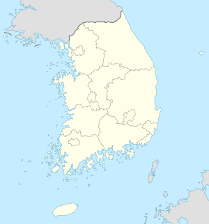

Gunpo Gunpo auf der Karte von Südkorea.Gunpo ist eine Stadt in der Provinz Gyeonggi-do in Südkorea. Sie ist Teil des Seoul National Capital Area. Die Hansei University ist in der Stadt beheimatet.
Gunpo liegt an der Linie 1 der U-Bahn Seouls, welche sie mit Seoul und Cheonan verbindet. Auch die Linie 4 läuft durch die Stadt und kreuzt die Linie eins bei der Geumjeong Station. Außerdem liegt die Stadt an der Gyeongbu-Linie, welche Seoul mit Busan verbindet.
Gliederung
Gunpo ist in elf dong unterteilt.
- Daeya-dong (대야동)
- Geumjeong-dong (금정동)
- Gumnae-dong (궁내동)
- Gunpo 1-dong (군포1동)
- Gunpo 2-dong (군포2동)
- Gwangjeong-dong (광정동)
- Jaegun-dong (재궁동)
- Ogeum-dong (오금동)
- Sanbon 1-dong (산본1동)
- Sanbon 2-dong (산본2동)
- Suri-dong (수리동)
Weblinks
- Offizielle Website (englisch)
Orte und Kreise in Gyeonggi-doVerwaltungssitz: Suwon
Städte (si): Ansan | Anseong | Anyang | Bucheon | Dongducheon | Gimpo | Goyang | Gunpo | Guri | Gwacheon | Gwangju | Gwangmyeong | Hanam | Hwaseong | Icheon | Namyangju | Osan | Paju | Pocheon | Pyeongtaek | Seongnam | Siheung | Suwon | Uijeongbu | Uiwang | Yangju | Yongin
Landkreise (gun): Gapyeong | Yangpyeong | Yeoju | Yeoncheon
Wikimedia Foundation.
Schlagen Sie auch in anderen Wörterbüchern nach:
Gunpo — Hangul : 군포시 Hanja : 軍浦市 Romanisation révisée : Gunpo si McCune Reischauer: Kunp o si … Wikipédia en Français
Gunpo — Infobox Korean settlement logo=Gunpo logo.gif hangul=군포시 hanja=軍浦市 rr=Gunpo si mr=Kunp o si area km2=36.35 pop=313413 popyear=2005 popden km2=7427.8 divs=11 dong Gunpo is a city in Gyeonggi Province, South Korea. It is part of the Seoul National… … Wikipedia
Gunpo-si — Admin ASC 2 Code Orig. name Gunpo si Country and Admin Code KR.13.8393793 KR … World countries Adminstrative division ASC I-II
Gunpo Station — Infobox SMS station caption= hangul=군포역 hanja=軍浦驛 rr=Gunpo yeok mr=Kunp o yŏk line1=P150 otherlines=Gyeongbu Line type=Aboveground platforms= screendoors=Not Installed operator=Korail opened=March 10, 1905 (passenger train service) August 15,… … Wikipedia
Dangjeong Station — Korean name Hangul 당정역 Hanja 堂 … Wikipedia
Gyeonggi-do — Coordinates: 37°30′N 127°15′E / 37.5°N 127.25°E / 37.5; 127.25 … Wikipedia
Cities and Counties of Gyeonggi-do — Administrative divisions of South Korea Provincial level Province (道 도 do) Special Self Governing Province (特別自治道 특별자치도 teukbyeoljachi do) Special city (特別市 특별시 teukbyeol si) Me … Wikipedia
Gyeonggi — Provinz Hangeul: 경기도 Hanja: 京畿道 Revidierte Romanisierung: Gyeonggi do McCune Reischauer: Kyŏnggi do Basisdaten Fläche: 10.189 km² Einwohner: 10.629.000 (Stan … Deutsch Wikipedia
KR-41 — Gyeonggi Provinz Hangeul: 경기도 Hanja: 京畿道 Revidierte Romanisierung: Gyeonggi do McCune Reischauer: Kyŏnggi do Basisdaten Fläche: 10.189 km² Einwohner: 10.629.000 (Stan … Deutsch Wikipedia
Sihung — Siheung Hangeul: 시흥시 Hanja: 始興市 Revidierte Romanisierung: Siheung si McCune Reischauer … Deutsch Wikipedia
Gunpo

18+
© Academic, 2000-2026
- Kontaktieren Sie uns: Unterstützung, Werbung
Wörterbücher Export, schritte mit PHP, Joomla, Drupal, WordPress, MODx.