Góra Puławska

Góra Puławska
Góra Puławska
Wappen fehlt
Hilfe zu Wappen
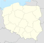
Góra Puławska (Polen)
Góra Puławska
Góra Puławska
Basisdaten
Staat: Polen
Woiwodschaft: Lublin
Landkreis: Puławy
Gmina: Puławy
Geographische Lage: 51° 24′ N, 21° 55′ O51.421.916666666667Koordinaten: 51° 24′ 0″ N, 21° 55′ 0″ O
Einwohner:

2098 (2006)

Postleitzahl: 24-100
Kfz-Kennzeichen: LPU

Góra Puławska ist ein Dorf der Gmina Puławy im Powiat Puławski, Woiwodschaft Lublin, Polen. Góra Puławska liegt an der Weichsel, ungefähr vier km südwestlich von Puławy und 49 km westlich von Lublin.

Geschichte

Die Siedlung bestand wahrscheinlich bereits im 10. / 11. Jahrhundert, doch die Namen der Grundherren sind erst seit dem 13. Jahrhundert bekannt. Im Jahr 1508 gehörte der Ort Jan Jarocki von Jaroszyn aus dem Geschlecht der Rawicz, ab 1731 August Aleksander Czartoryski. Die Czartoryski erbauten 1811 ein Herrenhaus, das bis 1939 bestand. Bis zum Ende des 19. Jahrhunderts betrieb die Familie im Dorf außerdem eine Gastwirtschaft und eine Brauerei. Der Besitz der Czartoryski wurde in Folge des Novemberaufstands konfisziert. Die letzten adligen Grundherren in Góra Puławska waren bis zum Zweiten Weltkrieg Angehörige der Familie Reinthal.

Im Zweiten Weltkrieg wurde der Ort stark zerstört. Der Wiederaufbau dauerte bis 1956.

Sehenswürdigkeiten

Zu den Sehenswürdigkeiten gehört die Kirche des Hl. Adalbert (św. Wojciecha), die 1767-1781 durch August Aleksander Czartoryski restauriert wurde.

Weblinks


Wikimedia Foundation.

Игры ⚽ Поможем написать курсовую

Schlagen Sie auch in anderen Wörterbüchern nach:

  • Góra Puławska — Infobox Settlement name = Góra Puławska settlement type = Village total type = image shield = subdivision type = Country subdivision name = POL subdivision type1 = Voivodeship subdivision name1 = Lublin subdivision type2 = County subdivision… …   Wikipedia

  • Kolonia Góra Puławska — Infobox Settlement name = Kolonia Góra Puławska settlement type = Village total type = image shield = subdivision type = Country subdivision name = POL subdivision type1 = Voivodeship subdivision name1 = Lublin subdivision type2 = County… …   Wikipedia

  • Voivodeship road — Standard voivodeship roads plates …   Wikipedia

  • Gmina Puławy — Infobox Settlement name = Gmina Puławy other name = Puławy Commune settlement type = Gmina total type = Total image shield = POL gmina Puławy COA.svg subdivision type = Country subdivision name = POL subdivision type1 = Voivodeship subdivision… …   Wikipedia

  • Dobrosławów —   Village   …   Wikipedia

  • Matygi —   Village   Country  Poland Voivodeship Lublin …   Wikipedia

  • Niebrzegów —   Village   …   Wikipedia

  • Nieciecz, Lublin Voivodeship — For other places with the same name, see Nieciecz (disambiguation). Nieciecz   Village   …   Wikipedia

  • Opatkowice, Lublin Voivodeship — For other places with the same name, see Opatkowice. Opatkowice   Village   …   Wikipedia

  • Доисторическая Польша —  История Польши …   Википедия

Share the article and excerpts

Direct link
Do a right-click on the link above
and select “Copy Link”