- Hanksville
-
Hanksville 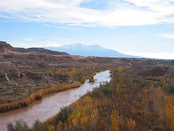
Im Hintergrund die Henry MountainsLage in Utah 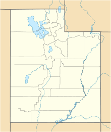

Hanksville Basisdaten Gründung: 1882 Staat: Vereinigte Staaten Bundesstaat: Utah County: Koordinaten: 38° 22′ N, 110° 43′ W38.373055555556-110.713333333331308Koordinaten: 38° 22′ N, 110° 43′ W Zeitzone: Mountain Standard Time (UTC−7) Einwohner: 197 (Stand: 2000) Höhe: 1308 m Hanksville ist ein kleiner Ort im östlichen Wayne County.
Geografie
Hanksville liegt an der Abzweigung der Utah State Route 24 und der Utah State Route 95, südlich vom Zusammenfluss des Fremont River und Muddy Creek. Beide bilden den Dirty Devil River, der in den Colorado River mündet.
Geschichte
Der Ort wurde 1882 gegründet. Der erste Pony-Express erreichte diesen Ort 1883. 1885 hat dieser Ort den Namen Hanksville erhalten.
Kategorie:- Ort in Utah


Wikimedia Foundation.