Jabal Marrah

Jabal Marrah
Dieser Artikel erläutert den Vulkan Marra. Für die Schweizer Politikerin siehe Ada Marra.
Marra
Höhe 3.088 m
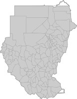
Lage im Westen Sudans
Gebirge Marra-Plateau
Geographische Lage 13° 2′ 39″ N, 24° 22′ 4″ O13.04416666666724.3677777777783088Koordinaten: 13° 2′ 39″ N, 24° 22′ 4″ O
Marra (Sudan)
DEC
Marra
Typ erloschener Vulkan
Erstbesteigung unbekannt
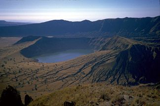
Einer der zwei Deriba-Seen im Zentrum des Vulkanberges. Photo von 1986.

Einer der zwei Deriba-Seen im Zentrum des Vulkanberges. Photo von 1986.

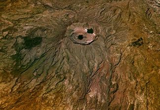
Der Marra (arabischجبل مرةDschabal Marra; auch Jebel Marra) ist ein erloschener Vulkan (3.088 m) auf dem Marra-Plateau im Westen Sudans.

Er liegt in den Bundesstaaten Schamal Darfur und Dschanub Darfur zwischen der Stadt al-Faschir und der Grenze zum Tschad.

Das Marra-Plateau umfasst eine Fläche von 1.500 km² und hat eine Höhe von 1.500 bis 3.088 m über dem Meeresspiegel.

Der Marra ist von einer Steinwüste umgeben und in seinem Zentrum findet man zwei Seen, die Deriba-Seen.

Siehe auch

Literatur

  • Sabine Miehe: Vegetation ecology of the Jebel Marra Massif in the semiarid Sudan. Cramer, Berlin 1988. ISBN 3-443-64025-7

Wikimedia Foundation.

Игры ⚽ Поможем написать реферат

Schlagen Sie auch in anderen Wörterbüchern nach:

  • Marrah Mountains — ▪ mountains, The Sudan Arabic  Jabal Marra,        mountain range, a rugged volcanic chain extending for 100 miles (160 km) west southwest of Al Fāshir, in west central Sudan. The highest point of the Nile Lake Chad watershed, the mountains reach …   Universalium

  • Geography of Sudan — The cities, towns and selected villages of Sudan and South Sudan Satellite image of Sudan …   Wikipedia

  • Islam in Sudan — Sudan is a religiously mixed country, although Muslims have dominated national government institutions since independence in 1956. Statistics indicate that the Muslim population is approximately 75% 80%, [Identity Politics: Filling the Gap… …   Wikipedia

  • Sudan — <p></p> <p></p> Introduction ::Sudan <p></p> Background: <p></p> Military regimes favoring Islamic oriented governments have dominated national politics since independence from the UK in 1956. Sudan …   The World Factbook

  • Nile River — Arabic Baḥr al Nīl River, eastern and northern Africa. The longest river in the world, it is about 4,132 mi (6,650 km) long from its remotest headstream and 3,473 mi (5,588 km) from Lake Victoria to the Mediterranean Sea. It flows generally north …   Universalium

  • Jebel Uweinat — The Mountain Uwaynat on the border of Egypt, Libya, Sudan Jebel Uweinat (1,934 m; جبل العوينات gabal al ʿuwaināt mountain of sourcelets ; also spelled Jabal, Djebel Al Awaynat, Auenat, Ouenat, Ouinat, Owainat, Oweinat, Uwaynat, Uweinat …   Wikipedia

  • Sudan, The — officially Republic of the Sudan Country, North Africa. Area: 966,757 sq mi (2,503,890 sq km). Population (2002 est.): 37,090,000. Capital: Khartoum. Muslim Arab ethnic groups live in the northern and central two thirds of the country, while… …   Universalium

Share the article and excerpts

Direct link
Do a right-click on the link above
and select “Copy Link”