- Junee Shire
-
Shire of Junee 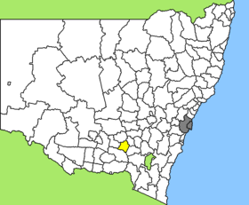
Lage des Junee Shire in New South WalesGliederung Staat:  Australien
Bundesstaat:  New South Wales
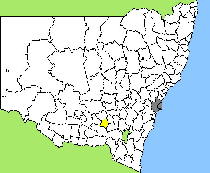
Verwaltungssitz: Junee Daten und Zahlen Fläche: 2.031 km² Einwohner: 5.774 (2006) [1] Bevölkerungsdichte: 2,8 Einwohner je km² -34.866666666667147.56666666667Koordinaten: 34° 52′ S, 147° 34′ OJunee Shire ist ein lokales Verwaltungsgebiet (LGA) im australischen Bundesstaat New South Wales. Das Gebiet ist 2.301 km² groß und hat etwa 5.800 Einwohner.
Junee liegt im Süden des Staates in der Murrumbidgee-Region etwa 220 km nordwestlich der australischen Hauptstadt Canberra und 430 km südwestlich der Metropole Sydney. Das Gebiet umfasst 28 Ortsteile und Ortschaften: Bendure, Bethungra, Bethungra South, Bute, Coreena, Coursing Park, Dirnaseer, Erin Vale, Eurongilly, Illabo, Ironbong, Junee, Junee North, Junee Reefs, Old Junee, Marinna, Mitta Mitta, Retreat, Retreat East, Rockview, Wantiool, Yathella und Teile von Downside, Harefield, Marrar, Nangus, Wallacetown und Wantabadgery. Der Sitz des Shire Councils befindet sich in Junee im Zentrum der LGA, wo etwa 3.700 Einwohner leben.
Verwaltung
Der Junee Shire Council hat neun Mitglieder, die von den Bewohnern der LGA gewählt werden. Junee ist nicht in Bezirke untergliedert. Aus dem Kreis der Councillor rekrutiert sich auch der Mayor (Bürgermeister) des Councils.
Weblinks
Einzelnachweise
- ↑ Australian Bureau of Statistics (25. Oktober 2007): Junee (A) (Local Government Area) (Englisch). 2006 Census QuickStats. Abgerufen am 6. April 2010.
Wikimedia Foundation.