Kadovar

Kadovar

Vorlage:Infobox Insel/Wartung/Bild fehlt

Kadovar
Gewässer Pazifischer Ozean
Inselgruppe Le-Maire-Inseln
Geographische Lage 3° 36′ 32″ S, 144° 35′ 18″ O-3.6088888888889144.58833333333365Koordinaten: 3° 36′ 32″ S, 144° 35′ 18″ O
Kadovar (Papua-Neuguinea)
Kadovar
Fläche 2 km²
Höchste Erhebung 365 m

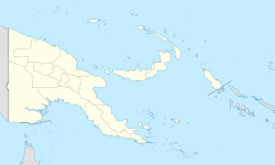
Kadovar, früher auch Blosseville-Insel genannt, ist eine kleine Vulkaninsel des südpazifischen Inselstaates Papua-Neuguinea (Provinz East Sepik).

Die etwa 2 km² große Insel gehört zu den Le-Maire-Inseln und liegt 45 km östlich vom Festland (Kap Girgir) sowie 5 km südlich der Insel Blup Blup. Der höchste Punkt von Kadovar befindet sich 365 m über Meeresniveau.

Die wenigen Bewohner der Insel siedeln in kleinen Dörfern an der Westküste und leben vom Fischfang.

Quellen & Weblinks


Wikimedia Foundation.

Игры ⚽ Нужен реферат?

Schlagen Sie auch in anderen Wörterbüchern nach:

  • Liste des volcans de Papouasie-Nouvelle-Guinée — Cet article recense les volcans de Papouasie Nouvelle Guinée. Sommaire 1 Liste 1.1 Nouvelle Guinée 1.2 Îles de l Amirauté 1.3 Bougainville …   Wikipédia en Français

  • Papua New Guinea — This article is about the country. For the Future Sound of London single, see Papua New Guinea (song). Independent State of Papua New Guinea Independen Stet bilong Papua Niugini …   Wikipedia

  • New Britain — This article is about the island of New Britain in Papua New Guinea. For other uses of the name, see New Britain (disambiguation). New Britain New Britain from space, June 2005. Clearly visible are ash plumes from Langila and Ulawun volcanoes …   Wikipedia

  • Manus Island — Manus Admiralty Islands …   Wikipedia

  • New Hanover Island — New Hanover New Hanover closeup map …   Wikipedia

  • Manam — Large ash plume From Manam Volcano, November 2004 Elevation 1,807 m (5,928 ft)  …   Wikipedia

  • D'Entrecasteaux Islands — (  / …   Wikipedia

  • Normanby Island (Papua New Guinea) — Normanby Topographic map of Normanby Island …   Wikipedia

  • Misima Island — Location within Louisiade Archipelago Misima Island from space …   Wikipedia

  • North Solomon Islands — The Northern Solomons were the more northerly group of islands in the Solomon Islands archipelago over which Germany declared a protectorate in 1885. Initially the German protectorate included Choiseul, Santa Isabel, the Shortlands and Ontong… …   Wikipedia

Share the article and excerpts

Direct link
Do a right-click on the link above
and select “Copy Link”