- Kapangan
-
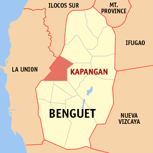
Municipality of Kapangan
Bayan ng KapanganLage von Kapangan in der Provinz Benguet 
Basisdaten Bezirk: Regierungsbezirk Cordillera Provinz: Benguet Barangays: 15 Distrikt: 2. Distrikt von Benguet PSGC: 141108000 Einkommensklasse: 4. Einkommensklasse Haushalte: 3371 Zensus 1. Mai 2000Einwohnerzahl: 18.221 Zensus 1. August 2007Koordinaten: 16° 35′ N, 120° 36′ O16.583333333333120.6Koordinaten: 16° 35′ N, 120° 36′ O Postleitzahl: 2613 Bürgermeister: Roberto Canuto Geographische Lage auf den Philippinen 

Kapangan Kapangan ist eine philippinische Stadtgemeinde in der Provinz Benguet. Sie hat 18.137 Einwohner in 3371 Haushalten (Zensus 1. Mai 2000).
Baranggays
Kapangan ist politisch unterteilt in 15 Baranggays.
- Balakbak
- Beleng-Belis
- Boklaoan
- Cayapes
- Cuba
- Datakan
- Gadang
- Gasweling
- Labueg
- Paykek
- Poblacion Central
- Pudong
- Pongayan
- Sagubo
- Taba-ao

Wikimedia Foundation.