- Karytaina
-
Karitena
Καρίταινα

Basisdaten Staat: Griechenland Verwaltungsregion: Peloponnes Präfektur: Arkadien Gemeinde: Gortyna Geographische Koordinaten: 37° 29′ N, 22° 3′ O37.48611111111122.041666666667Koordinaten: 37° 29′ N, 22° 3′ O Höhe ü. d. M.: 482 m Fläche: 21,232 km² Einwohner: 379 (2001[1]) Bevölkerungsdichte: 17,9 Ew./km² LAU-1-Code-Nr.: 12060100 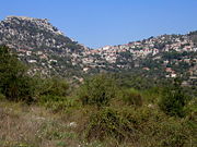 Karitena
Karitena (griechisch Καρίταινα (f. sg.)) ist ein Ortsteil und der Hauptort der Gemeinde Gortyna im Hochland von Arkadien am Peloponnes in Griechenland mit 379 Einwohnern.
Inhaltsverzeichnis
Geografie
Karitena liegt auf 482 m Seehöhe im Bergland Arkadiens, oberhalb der Alfios-Schlucht. Die Ortschaft ist auf einem Sattel gelegen, über den man von der Hochebene von Megalopoli an die Westküste der Peloponnes gelangt.
Geschichte
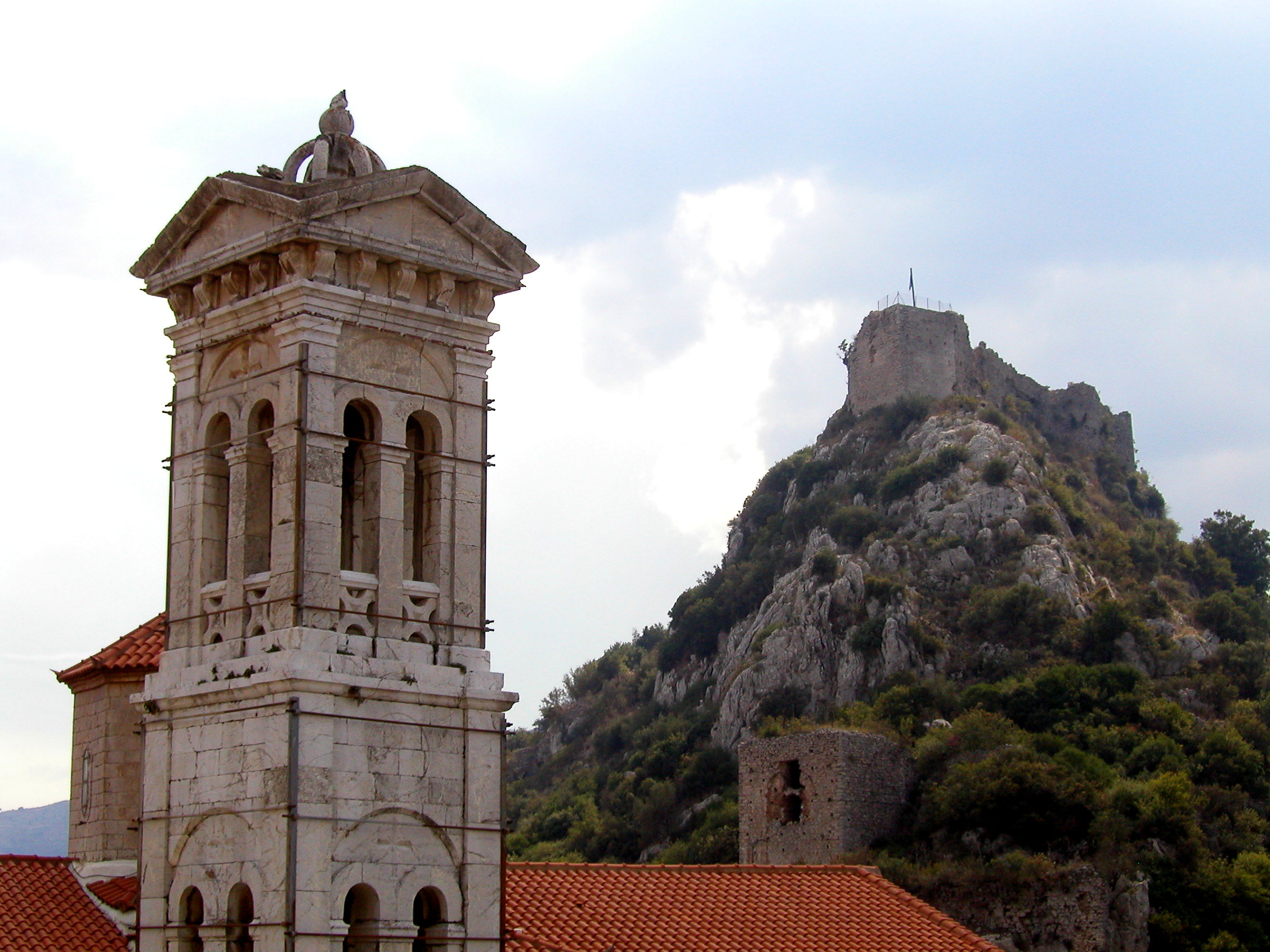
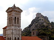 Kirchturm und Burg
Die Existenz eines antiken Vorläufers der Siedlung ist nicht gesichert. Zur Zeit der Franken wurde der Ort mit einer Festung gesichert, der im Lauf der Geschichte von Byzantinern und Osmanen erobert wurde. Von den Venezianern wurde die Burg trotz einiger Versuche nie eingenommen. Im Griechischen Unabhängigkeitskrieg von 1821 spielte der Ort eine tragende Rolle, er ist der Heimatort des Freiheitskämpfers Theodoros Kolokotronis.
Sehenswürdigkeiten
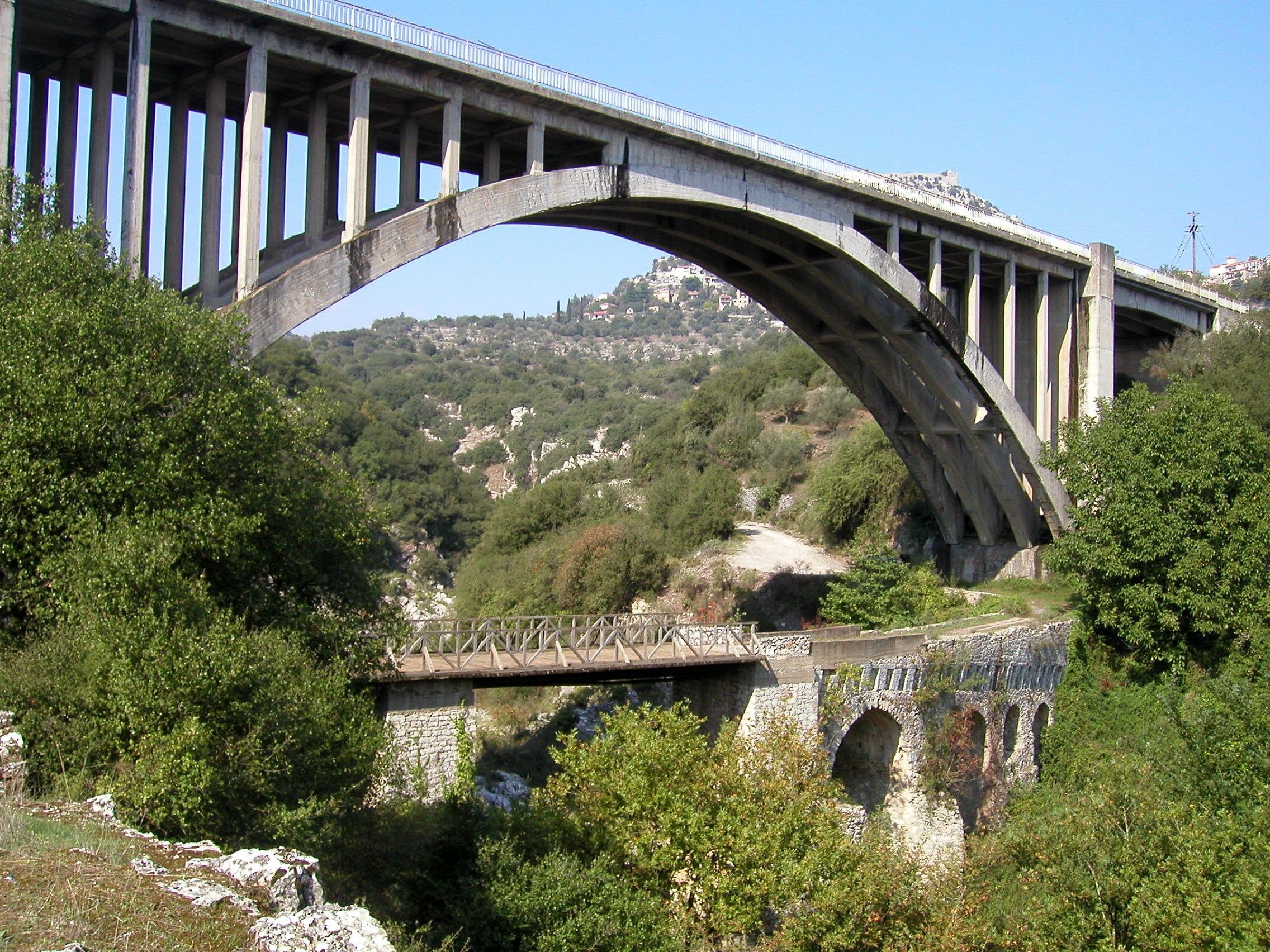
 Fränkische und neue Brücke über den Alfios
In Karitena gibt es eine Festung aus fränkischer Zeit die 1254 am westlichen Hügel über der Stadt errichtet wurde. Heute sind nur mehr Überreste der Anlage erhalten (Außenmauern). Die Anlage ist zu Fuß erreichbar, der Eintritt ist frei. Am Friedhof des Ortes befindet sich eine byzantinische, dem heiligen Nikolaus geweihte Kirche aus dem 17. Jahrhundert. Südlich des Ortes befindet sich eine fränkische Brücke über den Fluss Alfios.
Weblinks
Einzelnachweise


Wikimedia Foundation.