- Kogarah Council
-
Municipality of Kogarah 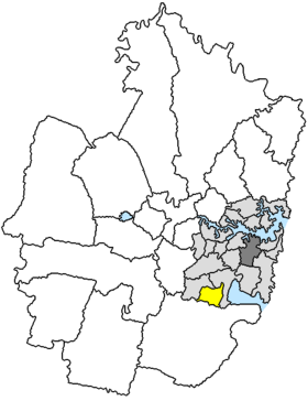
Lage von Kogarah in SydneyGliederung Staat:  Australien
Bundesstaat:  New South Wales
Verwaltungssitz: Kogarah Daten und Zahlen Fläche: 16 km² Einwohner: 52.537 (2006) [1] Bevölkerungsdichte: 3.284 Einwohner je km² Wards: 4 -33.966666666667151.13333333333Koordinaten: 33° 58′ S, 151° 8′ ODie Municipality of Kogarah ist ein lokales Verwaltungsgebiet (LGA) im australischen Bundesstaat New South Wales. Kogarah gehört zur Metropole Sydney, der Hauptstadt von New South Wales. Das Gebiet ist 16 km² groß und hat etwa 53.000 Einwohner.
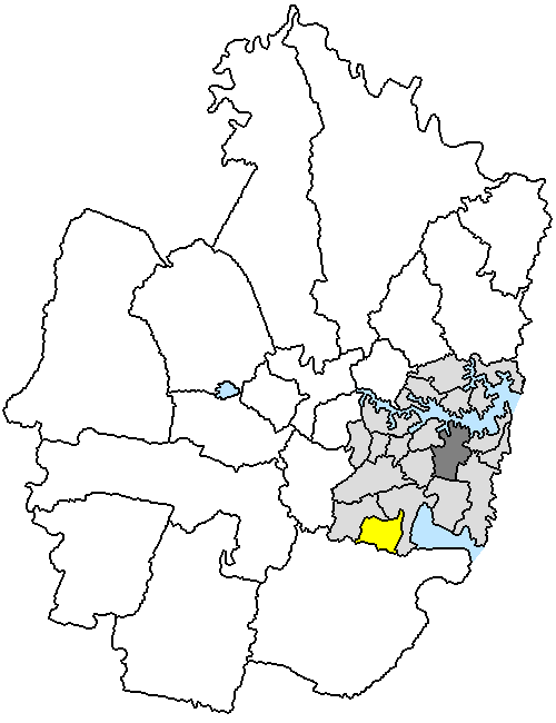
Kogarah liegt im Süden von Inner Sydney westlich von Botany Bay am Georges River etwa 15 km südwestlich des Stadtzentrums. Das Gebiet umfasst 20 Stadtteile: Bald Face, Beverley Park, Blakehurst, Carss Park, Connells Point, Hurstville Grove, Hurstville South, Kogarah Bay, Kyle Bay, Tom Uglys Point und Teile von Allawah, Carlton, Hurstville, Kogarah, Kogarah South, Mortdale, Oatley, Penshurst, Ramsgate und Sans Souci. Der Sitz des Shire Councils befindet sich im Stadtteil Kogarah im äußersten Nordosten der LGA.
Verwaltung
Der Kogarah Council hat zwölf Mitglieder, die von den Bewohnern der LGA gewählt werden. Je drei Mitglieder kommen aus den vier Wards East, Middle, North und West. Diese vier Bezirke sind unabhängig von den Stadtteilen festgelegt. Aus dem Kreis der Councillor rekrutiert sich auch der Mayor (Bürgermeister) des Councils.
Weblinks
Einzelnachweise
- ↑ Australian Bureau of Statistics (25. Oktober 2007): Kogarah (A) (Local Government Area) (Englisch). 2006 Census QuickStats. Abgerufen am 6. April 2010.
Kategorien:- Local Government Area in New South Wales
- Local Government Area in Sydney
Wikimedia Foundation.