Larrabee State Park

Larrabee State Park
Larrabee State Park

Der Larrabee State Park befindet sich im Whatcom County im Westen des US-Bundesstaats Washington. Er liegt etwa 11 km südlich von Bellingham am State Highway 11 (Chuckanut Drive).

Benannt ist der Park nach seinem Stifter Charles Xavier Larrabee, der 1915 zwanzig Acre (etwa acht Hektar) Land an den Staat stiftete. Zu dieser Zeit noch Chuckanut State Park genannt, war er mit einem Gebäude aus der Pionierzeit („John R. Jackson House State Historic Site“) einer der beiden ersten State Parks in Washington.

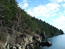
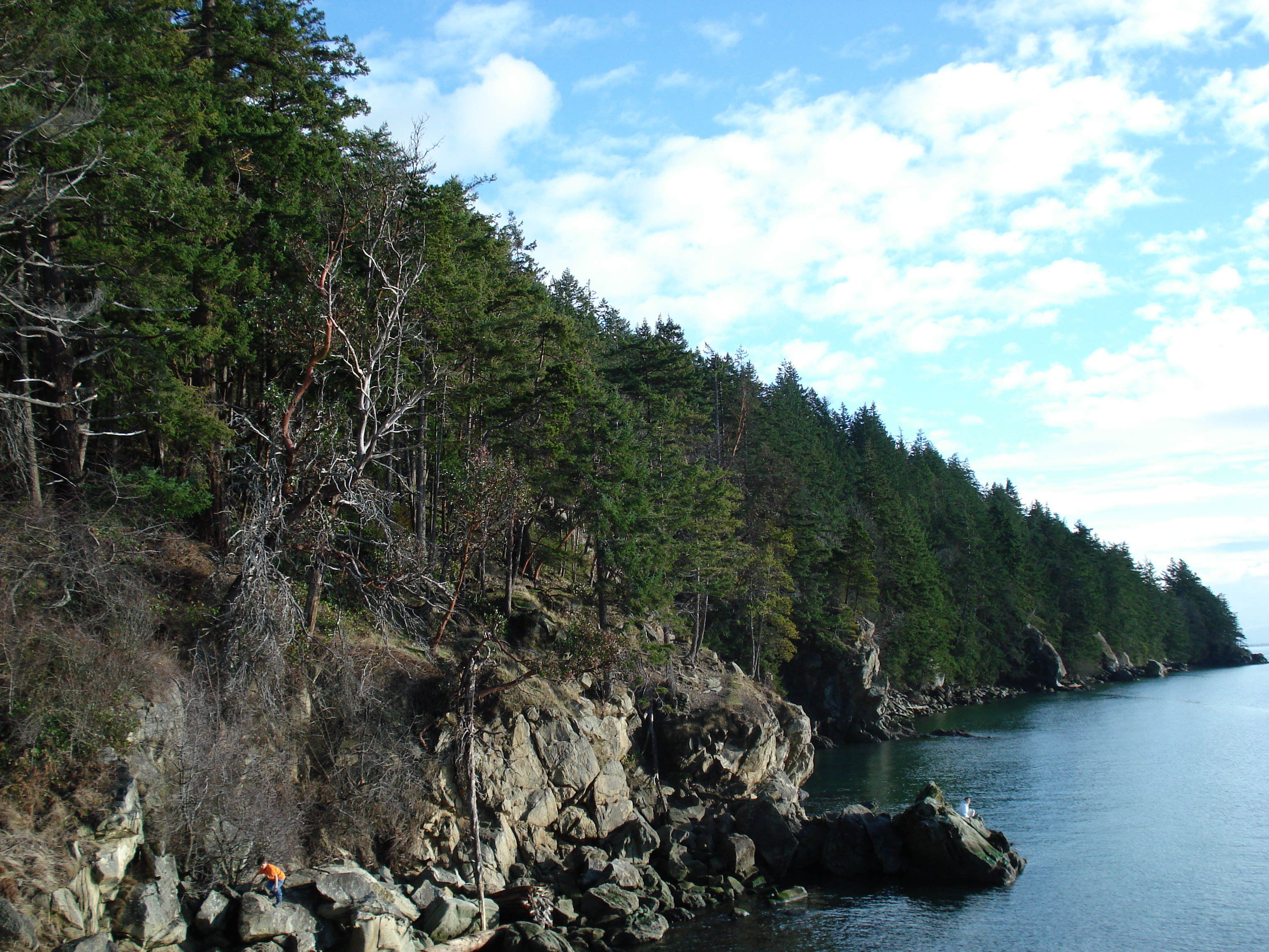
Heute umfasst der State Park eine Fläche von 2.683 Acre (etwa 1.073 Hektar) und knapp 2,5 km Küstenlinie an der Samish Bay. Der Park ist ganzjährig geöffnet, jedoch mit eingeschränkten Freizeitmöglichkeiten zwischen dem 16. Oktober und dem 31. März. Es stehen 75 Campingplätze zur Verfügung, davon 26 sogenannte "full hook-ups", d.h. mit Stromversorgung, Wasser- und Abwasseranschluss. Der Park verfügt über mehr als 38 km Wanderwege in den Chuckanut Mountains, die zum Teil zu Aussichtspunkten über die San Juan Islands und den Mount Baker und zum Fragrance Lake und zum Lost Lake, zwei Bergseen, führen. Freizeitmöglichkeiten im Park sind Schnorcheln, Angeln (inkl. Muscheln und Krabben) und Wandern.

Weblinks

48.656516-122.478441

Wikimedia Foundation.

Игры ⚽ Нужна курсовая?

Schlagen Sie auch in anderen Wörterbüchern nach:

  • Larrabee State Park — is a state park in Washington, located six miles (10 km) south of the city of Bellingham. It was the first state park to be created in Washington.HistoryLarrabee State Park had its beginnings in 1915, when the Larrabee family donated 20 acres of… …   Wikipedia

  • Riverside State Park — The Bowl and Pitcher formation. Location Spokane County, Washington, USA …   Wikipedia

  • Moran State Park — Mountain Lake in Moran State Park Moran State Park is a state park on Orcas Island, Washington, encompassing over 5,000 acres (20 km2)[1] of forest (much of it old growth) with some 30 miles of hiking trails …   Wikipedia

  • Olallie State Park — The Olallie State Park is a day use park in Washington around part of the Snoqualmie River. The most prominent feature of the park is Twin Falls. Snoqualmie River, in the Olallie Park. Contents 1 …   Wikipedia

  • Maryhill State Park — in Klickitat County, Washington is a camping park in the Washington State Park System.[1] It consists of 99 acres (40 ha) with 4,700 feet (1,400 m) of freshwater shoreline on the Columbia River. The Maryhill Stonehenge, a full scale… …   Wikipedia

  • Dosewallips State Park — Salt marsh shoreline in winter, Dosewallips State Park Dosewallips State Park in Jefferson County, Washington is one of the Washington State Parks.[1] It consists of 425 acres (172 ha) with 5,500 feet (1,700 m) of saltwater shoreline on …   Wikipedia

  • Nolte State Park — is a 117 acre (0.47 km2) day use park just south of Cumberland, Washington at the western edge of the Cascade Mountains, USA, with 7,174 feet (2,187 m) of freshwater shoreline on Deep Lake near the Green River Gorge. Covered with… …   Wikipedia

  • Conconully State Park — in Okanogan County, Washington is one of the Washington State Parks.[1] It consists of 81 acres (33 ha) with 5,400 feet (1,600 m) of freshwater shoreline. Available activities include camping, boating, fishing, waterskiing, horseshoes,… …   Wikipedia

  • Daroga State Park — in Douglas County, Washington is one of the Washington State Parks.[1] It consists of 90 acres (36 ha) along 1.5 miles (2.4 km) of Columbia River shoreline north of Orondo along the edge of Washington s Channeled Scablands. Available… …   Wikipedia

  • Larrabee — bezeichnet: Larrabee (GPU), ein Grafik Prozessor der Firma Intel Larrabee State Park, ein State Park im amerikanischen Bundesstaat Washington Orte in den Vereinigten Staaten: Larrabee (Iowa), Larrabee (Wisconsin) Larrabee Township (Kansas)… …   Deutsch Wikipedia

Share the article and excerpts

Direct link
Do a right-click on the link above
and select “Copy Link”