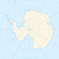
Lars Christensen Peak — Infobox Mountain Name = Lars Christensen Peak Photo = Caption = Elevation = convert|1755|m|ft|0|lk=on Location = Peter I Island, Southern Ocean Range = Prominence = convert|1755|m|ft|0|abbr=on Coordinates =… … Wikipedia
Lars Christensen — was a Norwegian shipowner and whaling magnate with a keen interest in the exploration of Antarctica.Christensen was born into a wealthy family. He inherited his whaling fleet from his rich father, Commander Christen Christensen.Whaling museum and … Wikipedia
Lars-Christensen-Gipfel — f1 Lars Christensen Peak Höhe 1.755 m Lage Peter I. Insel Geographische Lage … Deutsch Wikipedia
Pic Lars Christensen — Pour les articles homonymes, voir Christensen. Pic Lars Christensen Géographie Altitude … Wikipédia en Français
Lars Christensentoppen — f1 Lars Christensen Peak Höhe 1.755 m Lage Peter I. Insel Geographische Lage … Deutsch Wikipedia
Holder Peak — (coord|69|44|30.1|S|74|31|13.1|E|type:mountain) is the higher (northern) peak on a rock outcrop on the Ingrid Christensen Coast of Princess Elizabeth Land, about 4 km east of Mount Caroline Mikkelsen, in Antarctica. It is about 140 metres… … Wikipedia
Young Peak — There is also a group of features in Antarctica called the Young Peaks .Young Peak (coord|69|45|S|74|31|E|) is a low peak near the Antarctic coast, standing just south of Holder Peak and 2 miles (3.2 km) east of Mount Caroline Mikkelsen. First… … Wikipedia
Nevlingen Peak — (67°59′S 55°05′E / 67.983°S 55.083°E / 67.983; 55.083) A prominent isolated peak, 2,100 m, standing 13 mi SE of Doggers Nunataks in Enderby Land. Mapped by Norwegia … Wikipedia
Menipa Peak — (71°56′S 25°10′E / 71.933°S 25.167°E / 71.933; 25.167) is a peak, 2,590 m, standing 5 nautical miles (9 km) north of Mefjell Mountain in the central part of the … Wikipedia
Fram Peak — (coord|68|4|S|58|27|E|) is the northernmost peak in the Hansen Mountains, Antarctica. It was mapped by Norwegian cartographers from air photos taken by the Lars Christensen Expedition (1936 37) and named Framfjellet (the forward peak) … Wikipedia

