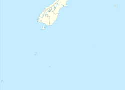
Antipodes Island

Antipodes Island
Antipodes Island
Eine Hütte für Schiffbrüchige im Norden der Insel
Gewässer Südpazifik
Inselgruppe Antipoden-Inseln
Geographische Lage 49° 41′ 16″ S, 178° 46′ 27″ O-49.687777777778178.77416666667366Koordinaten: 49° 41′ 16″ S, 178° 46′ 27″ O
Antipodes Island (New Zealand Outlying Islands)
Antipodes Island
Länge 6,8 km
Breite 5,7 km
Fläche 20 km²
Höchste Erhebung Mount Galloway
366 m
Einwohner (unbewohnt)
Die South Bay.Hier gingen 1893 die Schiffbrüchigen der Spirit of the Dawn an Land und hier verunglückte auch die Totorore.
Die South Bay.
Hier gingen 1893 die Schiffbrüchigen der Spirit of the Dawn an Land und hier verunglückte auch die Totorore.

Antipodes Island ist eine unbewohnte Vulkaninsel im südlichen Pazifischen Ozean. Sie ist die größte und Hauptinsel der zu Neuseeland gehörenden Antipoden-Inseln (engl. Antipodes Islands Group).

Geographie

Antipodes Island liegt etwa 770 km südöstlich der Südinsel Neuseelands. Die Insel ist 6,8 km lang, bis zu 5,7 km breit und weist eine Fläche von etwa 20 km² auf. Die Insel besteht aus mehreren Vulkanen vom Typ Schlackenkegel sowie Tuffkegel und erreicht im Mount Galloway eine Höhe von 366 m über dem Meer. Eine weitere nennenswerte Erhebung ist der Mount Waterhouse mit 358 m. Ihre Küste ist von steilen Kliffs aus Basalt geprägt; zahlreiche Klippen sind der Küste vorgelagert. Nördlich von Antipodes Island liegt das deutlich kleinere Bollons Island.

Geschichte

Die Inselgruppe und somit auch die Hauptinsel wurde 1800 von Henry Waterhouse, Kapitän der HMS Reliance, entdeckt. In der Folge sind zahlreiche Schiffe vor und an der Insel verunglückt: Am 4. September 1893 die The Spirit of Dawn, deren elf Überlebende drei Monate auf der Insel ausharren mussten. Unglücklicherweise war ihnen nicht bekannt, das im Nordosten der Insel eine Hütte mit Proviant eingerichtet worden war. Jene Hütte versorgte die Schiffbrüchigen der President Felix Faure im Jahre 1908. Das bislang letzte Unglück ereignete sich an 12. Juni 1999, als die Yacht Totorore sank und deren Segler den Tod fanden.

Weblinks


Wikimedia Foundation.

Игры ⚽ Поможем сделать НИР

Schlagen Sie auch in anderen Wörterbüchern nach:

  • Antipodes Island Parakeet — Taxobox name = Antipodes Island Parakeet status = VU status system = iucn3.1 status ref = [IUCN2006|assessors=BirdLife International|year=2004|id=5997|title=Cyanoramphus unicolor|downloaded=11 May 2006 Database entry includes a brief… …   Wikipedia

  • Antipodes Parakeet — A parakeet in Wellington Zoo s breeding program Conservation status …   Wikipedia

  • Antipodes Snipe — Scientific classification Kingdom: Animalia Phylum: Chordata Class: Aves …   Wikipedia

  • Antipodes Islands — The Antipodes Islands (from Greek αντίποδες antipodes [ [http://www.perseus.tufts.edu/cgi bin/ptext?doc=Perseus%3Atext%3A1999.04.0057%3Aentry%3D%2310380 Antipodes] , Liddell and Scott, A Greek English Lexicon , at Perseus.] ) are inhospitable… …   Wikipedia

  • Antipodes Islands — Lage der Antipoden Inseln südöstlich von Neuseeland Die Antipoden Inseln (engl.: Antipodes Islands) sind eine Gruppe unbewohnter Felsinseln vulkanischen Ursprungs, im Südpazifik. Sie gehören politisch zu Neuseeland und werden dort zu den New… …   Deutsch Wikipedia

  • Antipodes — For other uses, see Antipode (disambiguation). This map shows the antipodes of each point on the Earth s surface – the points where the blue and yellow overlap are land antipodes most land has its antipodes in the ocean. This map uses the Lambert …   Wikipedia

  • Antipodes Subantarctic Islands tundra — The Antipodes Subantarctic Islands tundra is a tundra ecoregion that includes five island groups in the Southern Ocean: the Bounty Islands, Auckland Islands, Antipodes Islands and Campbell Island groups of New Zealand, and Macquarie Island of… …   Wikipedia

  • Antipodes Islands — ▪ islands, New Zealand       outlying island group of New Zealand in the South Pacific Ocean, 350 miles (560 km) southeast of South Island, comprising a central island (5 by 3 miles [8 by 5 km]) and several islets. The total land area is 24… …   Universalium

  • Macquarie Island Parakeet — Taxobox name = Macquarie Island Parakeet status = status system = status ref = trend = image width = 250px image caption = regnum = Animalia phylum = Chordata classis = Aves ordo = Psittaciformes familia = Psittacidae subfamilia = Platycercinae… …   Wikipedia

  • Macquarie Island — Infobox World Heritage Site WHS = Macquarie Island State Party = AUS Type = Natural Criteria = vii, viii ID = 629 Region = Asia Pacific Year = 1997 Session = 21st Link = http://whc.unesco.org/en/list/629Macquarie Island lies in the southwest… …   Wikipedia

Share the article and excerpts

Direct link
Do a right-click on the link above
and select “Copy Link”