- Antreville
-

Dieser Artikel wurde aufgrund von inhaltlichen Mängeln auf der Qualitätssicherungsseite des Projektes USA eingetragen. Hilf mit, die Qualität dieses Artikels auf ein akzeptables Niveau zu bringen, und beteilige dich an der Diskussion! 
Antreville 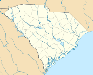

Antreville Lage in South CarolinaBasisdaten Staat: Vereinigte Staaten Bundesstaat: South Carolina County: Koordinaten: 34° 18′ N, 82° 33′ W34.304166666667-82.541944444444220Koordinaten: 34° 18′ N, 82° 33′ W Zeitzone: Eastern Standard Time (UTC−5) Einwohner: 118 (Stand: 2000) Bevölkerungsdichte: 11,6 Einwohner je km² Fläche: 10,2 km² (ca. 4 mi²)
davon 10,2 km² (ca. 4 mi²) LandHöhe: 220 m FIPS: 45-01810 GNIS-ID: 1244915 Antreville ist ein zu Statistikzwecken definiertes Siedlungsgebiet (Census-designated place) im Abbeville County im Bundesstaat South Carolina der Vereinigten Staaten von Amerika. Bei der Volkszählung im Jahr 2000 hatte es eine Einwohnerzahl von 118 auf einer Fläche von 10,2 Quadratkilometern. Die Bevölkerungsdichte liegt bei 12 Einwohnern pro Quadratkilometer.
Kategorie:- Ort in South Carolina


Wikimedia Foundation.