Makogai

Makogai

Vorlage:Infobox Insel/Wartung/Bild fehlt

Makogai
Gewässer Pazifischer Ozean
Inselgruppe Fidschi-Inseln
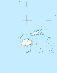
Geographische Lage 17° 25′ 47″ S, 178° 58′ 47″ O-17.429722222222178.97972222222267Koordinaten: 17° 25′ 47″ S, 178° 58′ 47″ O
Makogai (Fidschi)
Makogai
Länge 4,6 km
Breite 3,2 km
Fläche 8,4 km²
Höchste Erhebung Makongai
267 m
Hauptort Makongai

Makogai [ˌmakoˈŋai] ist eine Insel, die zur Provinz Lomaiviti des Staates Fidschi gehört.

Sie umfasst einen Bereich von 8,4 Quadratkilometern. Die maximale Höhe beträgt 267 Meter.

Makogai ist von Ovalau aus sichtbar. Früher diente die Insel als Aussätzigenkolonie.


Wikimedia Foundation.

Игры ⚽ Поможем решить контрольную работу

Schlagen Sie auch in anderen Wörterbüchern nach:

  • Makogai — (pronounced [makoˈŋai]) is an island belonging to Fiji s Lomaiviti Archipelago. Covering an area of 8.4 square kilometers, it is situated at 17.26° South and 178.58° East. It has a maximum altitude of 267 meters. Makogai is visible from Ovalau.… …   Wikipedia

  • Idioma lomaiviti — Lomaiviti Hablado en Fiyi Región Islas Koro, Makogai, Levuka, Ovalau, Batiki, Nairai y Gau Hablantes 1,627 (2000 WCD) Familia Lenguas austronesias Estatus oficial …   Wikipedia Español

  • List of Fiji-related articles — NOTOC Articles (arranged alphabetically) about people, places, things, and concepts related to or originating from Fiji, include: 0 9 2007 Colonial Cup A Rodney ACRAMAN Adi Adi Da James AH KOY Air Fiji Air Pacific Air Pacific destinations Ahmed… …   Wikipedia

  • Naigani — (pronounced [naiˈŋani]) is an island in Fiji s Tailevu Province, eight kilometers north west of Ovalau. It is also about 10 kilometers from Tailevu Point on the main island of Viti Levu. Coordinates: 17°34.99′S 178°40.99′E …   Wikipedia

  • Gau Island — Gau (pronounced [ˈŋau]) is an island belonging to Fiji s Lomaiviti Archipelago. Located at 18.00° S and 179.30 °E, it covers an area of 136.1 square kilometers, with a total shoreline of 66.3 kilometers, making it the 5th largest island in the… …   Wikipedia

  • Moturiki — is an island belonging to Fiji s Lomaiviti Archipelago. Covering an area of 10.4 square kilometers, it is situated at 17.45° South and 178.44° East. The island is inhabited by about 2000 Fijians living in 9 villages. Daku, Naicabecabe, Nasauvuki …   Wikipedia

  • Vicariate Apostolic of Fiji — The Vicariate Apostolic of Fiji was a Roman Catholic missionary jurisdiction comprising the islands belonging to the Fiji archipelago till 1966.Missions The Fiji Islands were included in the territory of the old Vicariate Apostolic of Central… …   Wikipedia

  • Nairai — is an island of Fiji belonging to the Lomaiviti Archipelago. The island is of volcanic origin and has a land area of about 30 square kilometers. Its latitude is 17°48 ; its longitude is 179°24 . Its population of approx. 5000 ???? (more… …   Wikipedia

  • Lomaiviti language — language name=Lomaiviti nativename= familycolor=Austronesian states=Fiji region=Koro, Makogai, Levuka, Ovalau, Batiki, Nairai, Gau islands speakers=1,627 (2000 WCD) fam2=Malayo Polynesian (MP) fam3=Central Eastern MP fam4=Eastern MP fam5=Oceanic… …   Wikipedia

  • Lomaiviti — Geographie Staat: Fidschi Gewässer: Pazifischer Ozean Inseln …   Deutsch Wikipedia

Share the article and excerpts

Direct link
Do a right-click on the link above
and select “Copy Link”