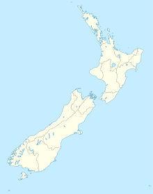
Aotea Harbour — is one of three large natural inlets in the Tasman Sea coast of the Waikato region of New Zealand s North Island. It is located between Raglan Harbour to the north and Kawhia Harbour to the south, 30 kilometres southwest of Hamilton. For further… … Wikipedia
Aotea — can refer to: *Great Barrier Island*Aotea Square, a square in downtown Auckland *Aotea Harbour, a natural harbour in New Zealand *Aotea (canoe), traditional canoe by which some Māori settled New Zealand *Aotearoa, the most popular Māori name for… … Wikipedia
Aotea — ist ein Māori Wort und bezeichnet: die Great Barrier Insel Aotea Square, einen Platz in der Stadtmitte Aucklands Aotea Harbour, einen Naturhafen in Neuseeland ein Kanu in der Mythologie der Māori einen Ort in der neuseeländischen Region Waikato,… … Deutsch Wikipedia
Aotea (canoe) — Infobox waka waka name =Aotea commander =Turi priest = departed = landed =Aotea Harbour iwi =Ngāti Ruanui settled =TaranakiIn Māori tradition, Aotea is one of the canoes by which Māori migrated to New Zealand; it is particularly associated with… … Wikipedia
Aotea Lagoon — Infobox lake lake name = Aotea Lagoon image lake = Aotea Lagoon,Porirua,NZ from north east.jpg caption lake = A view of Aotea Lagoon from the north east: Pipitea miniature railway station across the lagoon, State Highway 1, North Island Main… … Wikipedia
Kawhia Harbour — Lage des Kawhia Harbour Der Kāwhia Harbour ist einer von drei großen Meeresarmen der Tasmanischen See in der Region Waikato der Nordinsel Neuseelands. Er liegt südlich des Raglan Harbour, Ruapuke und Aotea Harbour, 40 km südwestlich von Hamilton … Deutsch Wikipedia
Kāwhia Harbour — Lage des Kawhia Harbour Der Kāwhia Harbour ist einer von drei großen Meeresarmen der Tasmansee in der Region Waikato der Nordinsel Neuseelands. Er liegt südlich des Raglan Harbour, Ruapuke und Aotea Harbour, 40 km südwestlich von Hamilton. Die… … Deutsch Wikipedia
Kāwhia Harbour — Kawhia Harbour is one of three large natural inlets in the Tasman Sea coast of the Waikato region of New Zealand s North Island. It is located to the south of Raglan Harbour, Ruapuke and Aotea Harbour, 40 kilometres southwest of Hamilton.The… … Wikipedia
Kawhia Harbour — Ubicación de Kawhia Harbour. Kawhia Harbour es una de las tres grandes ensenadas del Mar de Tasmania en la región de Waikato de Nueva Zelanda en la Isla del Norte. Está situada al sur de Raglan Harbour, Ruapuke y Aotea Harbour, 40 kilómetros al… … Wikipedia Español
Porirua Harbour — Porirua Harbour, nordöstlich der Markierung 4. 1 markiert Wellington, 2 und 3 sind Lower Hutt und Upper Hutt … Deutsch Wikipedia

