Marble Arch Caves

Marble Arch Caves
Marble Arch Caves
Lage: County Fermanagh bei Florencecourt, Nordirland
Geographische Lage: 54° 15′ 34″ N, 7° 49′ 20,1″ W54.259447222222-7.8222444444444Koordinaten: 54° 15′ 34″ N, 7° 49′ 20,1″ W
Marble Arch Caves (Nordirland)
Marble Arch Caves
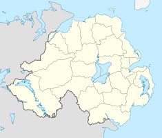
Geologie: Kalk
Typ: Wasserhöhle
Entdeckung: 1895
Schauhöhle seit: 1985
Beleuchtung: elektrisch
Website: Homepage

Die Marble Arch Caves (dt. Marmorbogenhöhlen) liegen im Kalksteinareal des County Fermanagh bei Florencecourt in Nordirland. Das südwestliche Gebiet ist für die Erne Lakes und für das Sandsteinplateau der Cuilcagh Mountain bekannt, das die Landschaft bis auf etwa 670 m über NN anhebt.

Das Wetter wird vom nur 56 km entfernten Atlantik beeinflusst. Im Moorland der Cuilcagh Mountain dringt der Regen in den Torf ein und erreicht nur sehr verzögert die Flüsse. Während des Sommers sind die Flüsse wasserarm, aber nach schwerem Niederschlag strömt eine große Menge Wasser die Hänge herab, wo der Torf den darunter liegenden Sandstein bedeckt. Sie laufen von dort in die unterirdischen Gänge der Marble Arch Caves, die seit 1895 erforscht werden und 2004 zum europäischen Geopark erklärt wurden. Ein Teil der Höhlen wird mit Booten befahren.

Weblinks


Wikimedia Foundation.

Игры ⚽ Поможем решить контрольную работу

Schlagen Sie auch in anderen Wörterbüchern nach:

  • Marble Arch Caves — Location near Florencecourt, County Fermanagh Depth 94 m Length 11.5 km (7.1 mi)[1] …   Wikipedia

  • Marble Arch Caves Global Geopark — The Marble Arch Caves Global Geopark straddles the border between Northern Ireland and the Republic of Ireland. It is centred on the Marble Arch Caves and in 2001 it became one of the first Geoparks to be designated in Europe. The Geopark… …   Wikipedia

  • List of caves — The following is a partial list of caves. Africa Algeria * Ain Bird Zaa El Kbira * Anou Achra Lemoun * Anou Boussouil * Anou Ifflis * Anou Timedouine * Aven Yebdar * Grotte Des Ain Beni Add * Kef Al Kaous * Rhar El Kahal * Rivière De La Tafna *… …   Wikipedia

  • List of caves in the United Kingdom — This is a list of caves in the United Kingdom, and information on the largest and deepest caves in the UK.The deepest cave in the UK is Ogof Ffynnon Ddu in Wales, 308 metres deep and containing around 50 km of passageways.The deepest cave in… …   Wikipedia

  • List of caves in Australia — Caves in Australiahow CavesNew South Wales*Abercrombie Caves *Ashford Caves*Bendethera Caves *Clifden Caves *Jenolan Caves *Tuglow Caves *Wellington Caves *Wombeyan Caves *Wyanbene Cave *Yarrangobilly CavesQueensland*Capricorn CavesSouth… …   Wikipedia

  • Oregon Caves National Monument — Coordinates: 42°05′44″N 123°24′21″W / 42.09556°N 123.40583°W / 42.09556; 123.40583 …   Wikipedia

  • Cuilcagh — Binn Chuilceach View from Cuilcagh Elevation …   Wikipedia

  • River Cladagh — This article is about the Co. Fermanagh river. For the river which flows from Co. Cavan into Co. Fermanagh and Upper Lough Erne, see River Cladagh (Swanlinbar). Coordinates: 54°17′10.73″N 7°47′29.19″W /  …   Wikipedia

  • Owenbrean River — Owenbrean (Abhainn Bhréan) River Country United Kingdom Region …   Wikipedia

  • Artur Kozłowski — Artur (Conrad) Kozłowski (17 October 1977, Poznan, Poland – 5 September 2011) was a Polish cave diver who spent his last years in Ireland.[1] Contents 1 Introduction to cave diving 2 Exploration …   Wikipedia

Share the article and excerpts

Direct link
Do a right-click on the link above
and select “Copy Link”