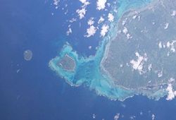
- Apolima
-
Apolima Apolima ganz links (Westen), Manono im Zentrum und Upolu rechts (Osten) Gewässer Apolima Strait, Pazifischer Ozean Inselgruppe Samoainseln Geographische Lage 13° 49′ 27″ S, 172° 9′ 5″ W-13.8241-172.1513165Koordinaten: 13° 49′ 27″ S, 172° 9′ 5″ W Länge 1,6 km Breite 900 m Fläche 1,4 km² Höchste Erhebung 165 m Einwohner 88 (2001)
63 Einw./km²Hauptort Apolima-Uta Apolima ist eine Insel Samoas, die zwischen den beiden Hauptinseln des Staates Samoa Savaiʻi und Upolu liegt. Die Insel liegt 8 km nordwestlich von Upolu und 9 km südöstlich von Savaiʻi. Manono liegt mit 2 km Entfernung am nächsten.
Apolima wird von einem Riff umschlossen, größere Schiffe können deswegen nicht in der Nähe der Insel anlegen, lediglich mit dem Kanu kann man das Eiland von einer der Nachbarinseln erreichen.
Die hauptsächlich aus Tuff-Gestein bestehende Insel war früher ein Vulkan, von dessen Caldera ein Teil in den Pazifik abrutschte. Am Rand der restlichen Caldera befindet sich heute der einzige Ort der Insel, Apolima-Uta, in dem alle 88 Einwohner des Eilands wohnen.
Die Insel gehört administrativ zum Bezirk Aiga-i-le-Tai.
2006 wurde Apolima mit ihren beiden Nachbarinseln Manono und Nuʻulopa zum UNESCO-Welterbe erklärt.
Weblinks
- Satelliten-Bild und Kurzbeschreibung (englisch)
- Klassifikation für das UNESCO-Welterbe (englisch)
- Apolima in Meyer´s Lexikon von 1905
Inseln der SamoainselnSamoa: Aleipata-Inseln | Apolima | Manono | Savaiʻi | Upolu
Amerikanisch-Samoa: Aunuʻu | Ofu-Olosega | Rose-Atoll | Taʻū | Tutuila
Wikimedia Foundation.
Schlagen Sie auch in anderen Wörterbüchern nach:
Apolima — Vue d Apolima. Géographie Pays … Wikipédia en Français
Apolima — is the smallest of the four inhabited islands of Samoa. It is a little less than one square kilometer in size. It is located in Apolima Strait between Upolu and Savai i and is 2.4 km northwest of the westernmost edge of Upolu s fringing barrier… … Wikipedia
Apolima — (»hohle Hand«), eine der kleinsten deutschen Samoainseln, an der Westküste von Upolu, ist 4,7 qkm groß und hat mit Manono (1900) 1038 Einw. Die Insel ist der Rand eines alten Kraters, der sich bis 144 m erhebt, nach W. aber eingestürzt ist, so… … Meyers Großes Konversations-Lexikon
Apolima — Apolima, eine der deutschen Samoa Inseln, 4,7, mit Manono 8,5 qkm (1902) 1070 E … Kleines Konversations-Lexikon
Apolima — Apolima, zu Samoa gehörende Insel, liegt zwischen dessen Hauptinseln Upolu und Savaii in der Apolimastraße. … Universal-Lexikon
Apolima Strait — The Apolima Strait separates the two main islands of Samoa, Savai i, to the northwest, and Upolu to the southeast. Three small islands lie in the strait, Manono, Apolima and tiny uninhabited Nu ulopa … Wikipedia
Détroit d'Apolima — Vue de l île d Apolima (à gauche) et de l extrémité de Savai i (à droite) depuis le ferry franchissant le détroit. Géographie humaine … Wikipédia en Français
Isla Apolima — Postal de la isla Apolima. La isla de Apolima es la más pequeña de las cuatro islas habitadas de Samoa. Posee menos de un kilometro cuadrado de superficie. Está situado en el estrecho de Apolima entre Upolu y Savai i y está noroeste, 2.4… … Wikipedia Español
Samoan Islands — For other uses, see Samoa (disambiguation). Samoan Islands Olosega island in the Manu a group, eastern Samoa Islands … Wikipedia
Manono Island — Manono Satellite image of Manono island with Upolu to the east and tiny Apolima island to the west (NASA photo) Geography … Wikipedia