Marondera

Marondera
-18.20833333333331.55
Marondera (Simbabwe)
Marondera
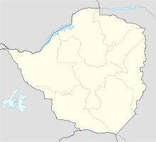
Marondera

Marondera, benannt nach dem örtlichen Barozwi-Häuptling vor über 100 Jahren, bis 1982 Marandellas, liegt 73 km südlich von Harare an Straße und Eisenbahnlinie nach Mutare in der Provinz Ostmashonaland in Simbabwe. Marondera ist die Hauptstadt der Provinz.

Marondera wurde 1890 als Rasthaus gegründet und ist mit 1.640 m die am höchsten gelegene Stadt Simbabwes. Hier entspringt der größte Fluss des Landes, der Save. Die Stadt war eine der ersten weißen Siedlungen des Landes, ist umgeben von Feldern, vor allem Mais, Tabak und Wein, einigen Kautschuk-Plantagen und ist eine von Landwirtschaft geprägte Stadt. Sie hat etwa 40.000 Einwohner, beherbergt einige Kleinindustrie, Grund- und Sekundärschulen, zwei Colleges, ein Krankenhaus. Es ist einer der ganz wenigen Orte in Simbabwe, in dem Kinder fast nur wegen Atemwegserkrankungen durch "Hausrauch" behandelt werden, weil der durch das Grasdach der Hütten zu langsam abzieht. Im Vergleich zu anderen Orten sind das idyllische Zustände, vor allem wenn die Lage an der viel frequentierten Fernstraße berücksichtigt wird, was überall sonst ursächlich für die Verbreitung von AIDS ist. Die Stadt hat Telefon, Elektrizität und Wasserversorgung, wenn auch nicht ununterbrochen, obwohl zwei Stauseen in der Nähe der Stadt liegen. Es fehlen Ersatzteile und Devisen. Treibstoffe und Lebensmittel sind knapp wie im übrigen Land auch.


Wikimedia Foundation.

Игры ⚽ Поможем написать курсовую

Schlagen Sie auch in anderen Wörterbüchern nach:

  • Marondera — Marandellas redirects here. For the British steamship in service 1951 56, see SS Marandellas. Marondera (Marandellas)   City   …   Wikipedia

  • Marondera — 18° 11′ 23″ S 31° 32′ 49″ E / 18.1896451, 31.5468121 …   Wikipédia en Français

  • Marondera — ▪ Zimbabwe formerly  Marandellas,    town, northeastern Zimbabwe. It originated in 1890 as a rest house on the road from Harare (formerly Salisbury) to Mutare (formerly Umtali) and was named for Marondera, chief of the ruling Barozwi people.… …   Universalium

  • Marondera — Original name in latin Marondera Name in other language Marandellas, Marondera State code ZW Continent/City Africa/Harare longitude 18.18527 latitude 31.55193 altitude 1668 Population 57082 Date 2010 08 03 …   Cities with a population over 1000 database

  • Marondera East — is a constituency of Zimbabwe. It belongs to the Eastern province of Mashonaland East. It is named after the town of Marondera. In the March 2005 parliamentary election, the candidate of Zanu PF, Sydney Sekeramayi, was declared the winner. This… …   Wikipedia

  • Marondera High — School is a co educational high school located one and half miles from the Marondera town centre, in Mashonaland East Province, Zimbabwe. The school was established in 1965. This school is one of the first schools in Marondera. It shares fences… …   Wikipedia

  • Marondera District — Admin ASC 2 Code Orig. name Marondera District Country and Admin Code ZW.00.886989 ZW …   World countries Adminstrative division ASC I-II

  • Marondera — Marandellas stor …   Sinonimi e Contrari. Terza edizione

  • List of Zimbabwean parliamentary constituencies — Zimbabwe This article is part of the series: Politics and government of Zimbabwe President Robert Mugabe …   Wikipedia

  • Mudzi West — is a constituency of Zimbabwe. It belongs to Mudzi district in Mashonaland. This is a rural area. More than 11,000 votes at the 2005 general election were not accounted for.[citation needed] …   Wikipedia

Share the article and excerpts

Direct link
Do a right-click on the link above
and select “Copy Link”