- Maupiti
-
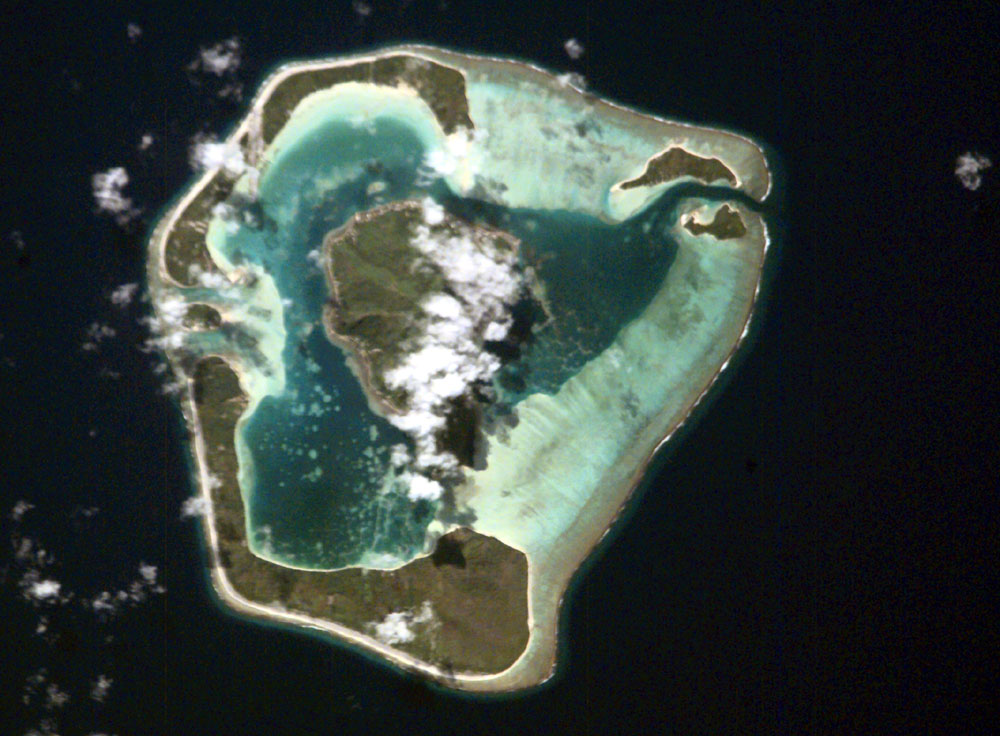
Maupiti Astronautenfoto von Maupiti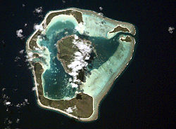
Gewässer Pazifischer Ozean Archipel Gesellschaftsinseln Geographische Lage 16° 27′ S, 152° 15′ W-16.445627777778-152.25596666667Koordinaten: 16° 27′ S, 152° 15′ W 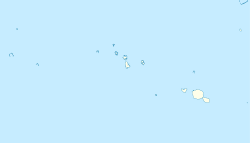

Anzahl der Inseln 6 Hauptinsel Maupiti Landfläche 11 km² Höchste Erhebung Mont Teurafaatui
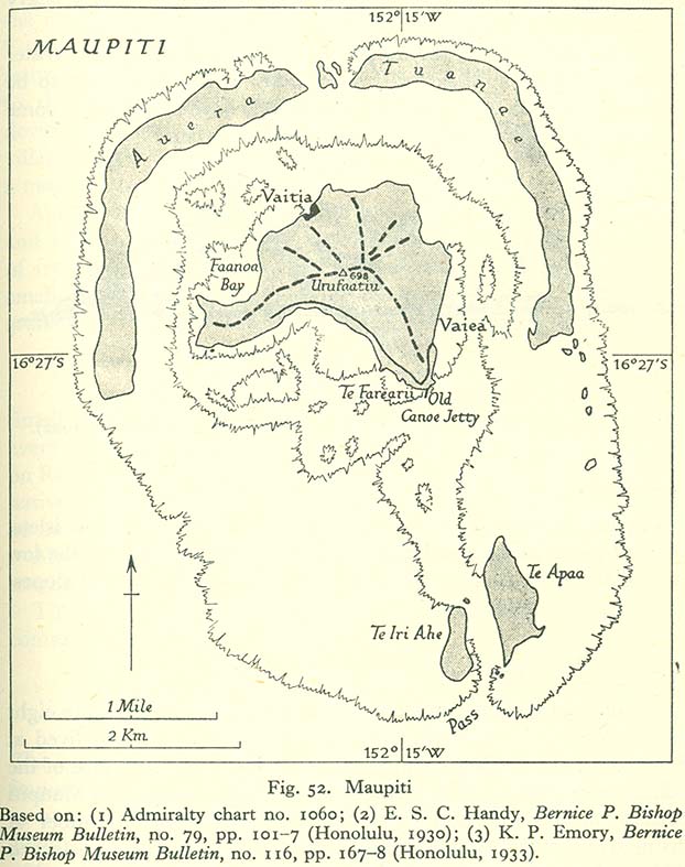
380 mEinwohner 1248 (2007) Karte des Atolls. Dargestellte und aktuelle Namen der Motus: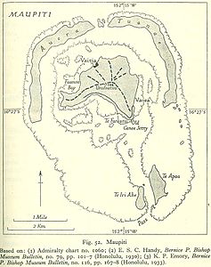
Te Iri Ahe = Pitiahe
Te Apaa = Tiapaa
Auera = Auira
Tuanae = Tuanai
(nördl. Motu) = PaeʻaoMaupiti ist ein Atoll im Pazifischen Ozean. Es liegt in der Mitte der Inseln unter dem Winde (frz. Îles sous le Vent) der Gesellschaftsinseln und gehört zu Französisch-Polynesien.
Geographie
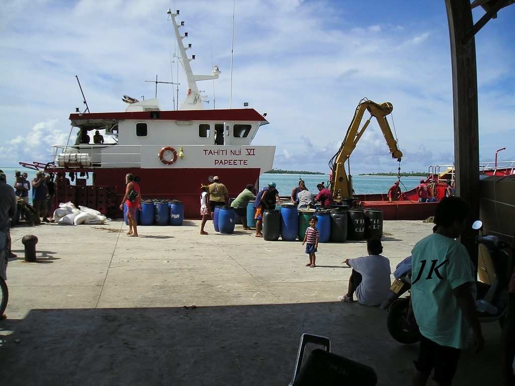
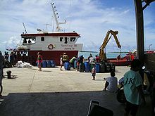 Ein Noni-Schiff beim Verladen im Hafen von Maupiti
Maupiti bildet eine klassische Atollstruktur mit einer 380 m hohen Vulkaninsel im Zentrum sowie einem Saumriff, welchem fünf flache Motus aufliegen, aus. Zwischen den beiden südlichen Motus Tiapaa (östlich) und Pitiahe (westlich) befindet sich die Bootsdurchfahrt Onoiau Pass. Der Flughafen sowie einige Pensionen liegen auf dem großen nordöstlichen Motu Tuanai. Die gesamte Landfläche beträgt 11 km². Maupiti hat 1.248 Einwohner (Stand: 2007), von denen der Großteil im Hauptort Vaiea an der Ostküste der Zentralinsel lebt. Die nächste, wichtige Insel ist Bora Bora, 40 Kilometer östlich gelegen. Haupterwerbszweig ist die Produktion und Vermarktung von Noni (Baumfrucht).
Entdeckung
Der erste Europäer, der die Insel entdeckte, war der holländische Weltumsegler Jakob Roggeveen im Jahre 1722.
Literatur
Schlagen Sie auch in anderen Wörterbüchern nach:
MAUPITI — Une des îles Sous le Vent en Polynésie française, Maupiti est située à un peu moins de 50 kilomètres à l’ouest de Bora Bora, par 160 26 de latitude sud et 1540 32 de longitude ouest. Elle est peu étendue (environ 25 km2) et les restes du volcan… … Encyclopédie Universelle
Maupiti — es una de las islas de Sotavento de las islas de la Sociedad, en la Polinesia Francesa. Es la isla volcánica más occidental del archipiélago, a 40 km al oeste de Bora Bora. Sus coordenadas son: 16°25′S 152°15′O / … Wikipedia Español
Maupiti — (Maurna), eine der bewohnten Gesellschaftsinseln (südöstliches Polynesien), von Riffen umgeben, gute Häfen; gebirgig, aber fruchtbar … Pierer's Universal-Lexikon
Maupiti — Pour les articles homonymes, voir Maupiti (homonymie). Maupiti Carte topographique des îles et atolls de la … Wikipédia en Français
Maupiti — Coordinates: 16°25′S 152°15′W / 16.417°S 152.25°W / 16.417; 152.25 For the administrative commune which includes the isl … Wikipedia
Maupiti (commune) — Maupiti Location of the commune (in red) within the Leeward Islands. The atolls of Maupihaa (Mopelia), Manuae (Scilly), and Motu One (Bellinghausen) lie outside of the map … Wikipedia
Maupiti-Monarch — (Pomarea pomarea) Systematik Klasse: Vögel (Aves) Ordnung: Sperlings … Deutsch Wikipedia
Maupiti Airport — IATA: MAU – ICAO: NTTP Summary Airport type Public Operator Government Location … Wikipedia
Maupiti Island (game) — Maupiti Island Developer(s) Lankhor Publisher(s) Lankhor Designer(s) Sylvian Bruchon, Dominique Sablons, André Bescond … Wikipedia
Maupiti Monarch — Conservation status Extinct (IUCN 3.1) … Wikipedia
Maupiti

18+
© Academic, 2000-2026
- Kontaktieren Sie uns: Unterstützung, Werbung
Wörterbücher Export, schritte mit PHP, Joomla, Drupal, WordPress, MODx.