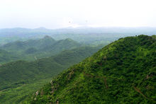
Aravalli — Ârâvalli Ârâvalli Carte de localisation de l Ârâvalli. Géographie Altitude 1 720 m, Gurû Sikhara … Wikipédia en Français
Ârâvalli — 25°00′N 73°30′E / 25, 73.5 … Wikipédia en Français
Aravalli Range — The Aravalli Range is a range of mountains in western India running approximately 800 km from northeast to southwest across Rajasthan state. The northern end of the range continues as isolated hills and rocky ridges into Haryana state, ending… … Wikipedia
Aravalli Range — ▪ hill system, India also spelled Aravali Range hill system of northern India, running northeasterly for 350 miles (560 km) through Rajasthan (Rājasthān) state. Isolated rocky offshoots continue to just south of Delhi. The series of peaks … Universalium
Aravalli Range — geographical name mountain range NW India E of Thar Desert; highest peak Mt. Abu 5650 feet (1722 meters) … New Collegiate Dictionary
Geographie de l'Inde — Géographie de l Inde Géographie de l Inde Continent Asie Région Sous continent indien (Asie du sud) Coordonnées 20°00 N 77°00 E Superficie … Wikipédia en Français
Géographie De L'Inde — Continent Asie Région Sous continent indien (Asie du sud) Coordonnées 20°00 N 77°00 E Superficie … Wikipédia en Français
Géographie de l'Inde — Continent Asie Région Sous continent indien (Asie du sud) Coordonnées 20°00 N 77°00 E Superficie … Wikipédia en Français
Géographie de l'inde — Continent Asie Région Sous continent indien (Asie du sud) Coordonnées 20°00 N 77°00 E Superficie … Wikipédia en Français
Delhi ridge — Delhi ridge, sometimes simply called The Ridge, is a ridge in the National Capital Territory of Delhi in India.[1] The ridge is a northern extension of the ancient Aravalli Range, some 1500 million years old (compared to just 50 million for the… … Wikipedia

