Moturoa Islands

Moturoa Islands
Moturoa Islands
Gewässer Pazifischer Ozean
Geographische Lage 34° 46′ S, 173° 21′ O-34.770454102778173.34717750556Koordinaten: 34° 46′ S, 173° 21′ O
Moturoa Islands (Neuseeland)
Moturoa Islands
Anzahl der Inseln
Gesamtfläche dep1

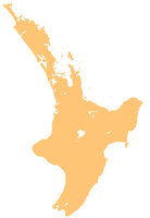
Die Moturoa Islands sind eine Gruppe kleiner Inseln nördlich der Karikari Peninsula im Far-North-Distrikt in der Region Northland auf Nordinsel Neuseelands.

Die Inseln erstrecken sich von Taumatare Point im Norden der Karikari Peninsula in nordwestlicher Richtung in den Pazifik und bilden damit das nordöstliche Ende der Rangaunu Bay auf der Aupouri Peninsula.

Die namensgebende Insel Moturoa Island ist 9 Hektar groß, 4.375 Meter vom nächsten Punkt des Festlandes entfernt und 54 Meter hoch.[1]

Weitere Inseln sind von Süden nach Norden Tuputupungahau Island, Sugarloaf Island und Motutapu Island, hinzu kommen weitere Inselchen und Felsen.

Die Inseln sind rattenfrei und daher als Brutgebiet für Seevögel und wegen heimischer Eidechsen von Bedeutung [2]

Quellen

  1. Rodent Invasion Project
  2. www.edesignz.co.nz

Wikimedia Foundation.

Игры ⚽ Поможем решить контрольную работу

Schlagen Sie auch in anderen Wörterbüchern nach:

  • Moturoa Island — bezeichnet zwei Inseln in Neuseeland Moturoa Island, eine Insel der Inselgruppe der Moturoa Islands vor der Karikari Peninsula in der Region Northland Moturoa Island (Bay of Islands) in der Bay of Islands in der Region Northland Moturoa Island… …   Deutsch Wikipedia

  • Islands, Bay of — Inlet, South Pacific Ocean, on the northeastern coast of North Island, New Zealand. The bay was formed when the sea flooded an old river valley system. It has a 500 mi (800 km) shoreline and about 150 islands. It opens to the ocean through a… …   Universalium

  • Bay of Islands — The Bay of Islands is an area in the Northland region of the North Island of New Zealand. Located 60 km north west of Whangarei, it is close to the northern tip of the country.It is one of the most popular fishing, sailing and tourist… …   Wikipedia

  • Bay of Islands — Blick von einer kleinen Insel auf die Bucht Der Begriff Bay of Islands (dt: Bucht der Inseln) bezeichnet einen Küstenabschnitt im Norden der neuseeländischen Nordinsel. Die Bucht befindet sich in der subtropischen Region Northland, genauer gesagt …   Deutsch Wikipedia

  • Bay of Islands — 35°12′S 174°10′E / 35.2, 174.167 …   Wikipédia en Français

  • Karikari Peninsula — …   Wikipedia

  • Karikari Peninsula — Gewässer Pazifischer Ozean Geographische Lage …   Deutsch Wikipedia

  • Rangaunu Bay — …   Deutsch Wikipedia

  • Coastal fortifications of New Zealand — The New Zealand coastline is 15,134 km long. Coastal fortifications were constructed in New Zealand in two main waves. The first wave occurred around 1885 and was a response to fears of an attack by Russia. The second wave occurred during World… …   Wikipedia

  • History of New Plymouth — The city of New Plymouth, New Zealand, has a history that includes a lengthy occupation and residence by Maori, the arrival of white traders and settlers in the 19th century and warfare that resulted when the demands of the two cultures… …   Wikipedia

Share the article and excerpts

Direct link
Do a right-click on the link above
and select “Copy Link”