- Mount Akutan
-
Mount Akutan 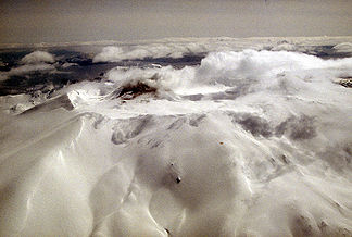
Höhe 1.303 m Lage Alaska-Halbinsel (USA) Gebirge Aleutenkette Geographische Lage 54° 8′ 4″ N, 165° 59′ 10″ W54.134444444444-165.986111111111303Koordinaten: 54° 8′ 4″ N, 165° 59′ 10″ W 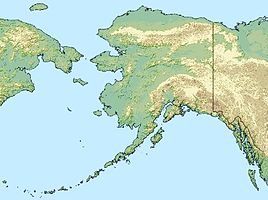

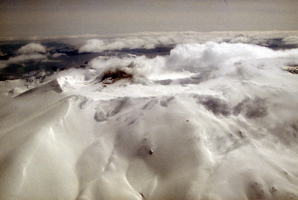
Typ Schichtvulkan Letzte Eruption 1992 Der Mount Akutan ist ein 1.303 m hoher Stratovulkan der Aleutenkette auf der Alaska-Halbinsel. Mount Akutan gehört zu den aktivsten Vulkanen der Region. Sein Gipfel besteht aus einer 2 Kilometer breiten und bis zu 365 Meter tiefen Caldera. Zwei Ausbruchszentren liegen an der Nordwest-Flanke. Ein Schlackenkegel produzierte 1852 einen Lavastrom, welcher die Küstenlinie vergrößerte und "Lava Point" formte. Die Caldera wurde während einer explosiven Eruption vor rund 1600 Jahren gebildet und enthält mindestens drei Kraterseen. Der aktive Schlackenkegel im Nordostteil der Caldera ist die Quelle von häufigen explosiven Eruptionen in der jüngeren Vergangenheit (auch Lava-Austritt). 1978 durchquerte ein Lavastrom einen engen Durchbruch im nördlichen Teil der Caldera-Wand und reichte beinahe bis zur Küste. Auf dem Caldera-Grund befinden sich einige Fumarolen und heiße Quellen finden sich im Nordosten der Caldera und entlang der Küste bei Hot Springs Bay. In der Umgebung des Vulkans finden sich mehrere Thermalquellen.
Frühere, zum Teil schwere Eruptionen, wurden mit Hilfe der Radiokarbon-Methode auf 7620 ± 300 v. Chr., zirka 4.150 v. Chr. sowie auf etwa das Jahr 340 (Auswurf von mehreren Kubikkilometern Tephra) datiert. Historische Aufzeichnungen belegen zudem Ausbrüche in den Jahren 1848, 1852, 1865, 1867, 1883, 1887, September 1892, 1896, 1907, Februar 1908, 1911, 1927 bis 1928, 1929, Mai bis August 1931, Dezember 1946 bis Januar 1947, April bis August 1948, Oktober 1951, 1953, November 1962, 1972, 1973, 1974, 1976, 1978, Juli 1980, Oktober 1982 bis Mai 1983, 18. März bis 30. Juni 1986, 31. Januar bis 24. Juni 1987, 26. März bis 20. Juli 1988, 27. Februar bis März 1989, Januar 1990, 6. September bis Oktober 1990, 15. September bis Oktober 1991, 8. März bis 21. Mai 1992 sowie Dezember 1992.
 Lage des Mount Akutan auf der Alaska-Halbinsel
Weblinks
- Beschreibung beim Alaska Volcano Observatory (englisch)
- Mount Akutan im Global Volcanism Program der Smithsonian Institution (englisch)


Wikimedia Foundation.