- Akutan Island
-
Akutan NASA-Bild von Mount Akutan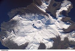
Gewässer Pazifischer Ozean Inselgruppe Aleuten Geographische Lage 54° 8′ N, 165° 55′ W54.128055555556-165.918055555561303Koordinaten: 54° 8′ N, 165° 55′ W 

Länge 31 km Breite 24 km Fläche 334 km² Höchste Erhebung Akutan Peak
1.303 mEinwohner 713 (2000)
2,1 Einw./km²Hauptort Akutan Mount Akutan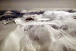
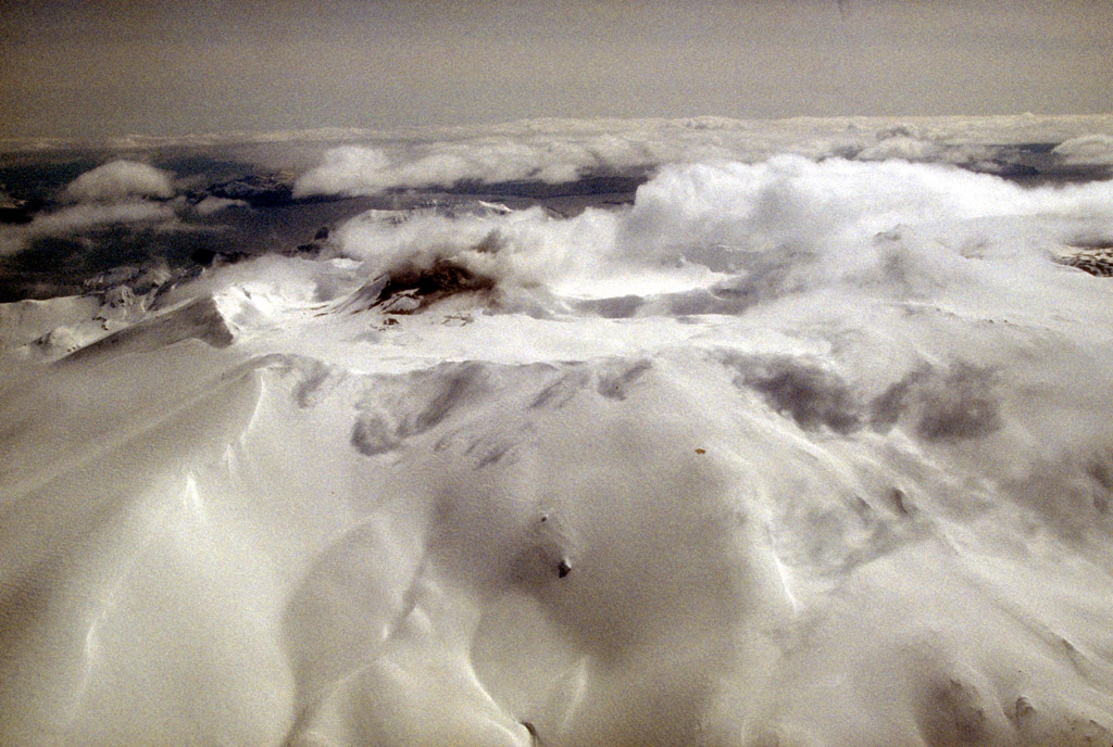
Akutan Island ist eine Insel der Fox Islands, einer Inselgruppe in den östlichen Aleuten, Alaska. Die Insel ist etwa 31 km lang, bis zu 24 km breit und hat eine Landfläche von 334,13 km². Sie ist die viertgrößte Insel der Fox Islands und die größte Insel der Krenitzin Islands, einer Untergruppe der Fox Islands. Die Insel ist von 713 Personen besiedelt, die alle in dem Ort Akutan auf der Ostseite der Insel wohnen. Im Südwesten trennt der Akutan Pass die Insel von den Baby Islands, Unalga Island und Unalaska Island; im Nordosten trennt sie die Akun Strait von Akun. Der westliche Teil der Insel wird dominiert vom sehr aktiven Schichtvulkan Mount Akutan, dessen letzte größere Lava-Eruption 1979 stattfand. Im Hot Springs Bay Valley gibt es heiße Quellen und Fumarole.
P. K. Krenitzin und M. Levashev berichteten 1768, dass Akutan ist ein Name aus der Aleuten-Sprache Unangan Tunuu sein könnte und vom Wort „hakuta“ stammen, das gemäß R. H. Geoghegan „Ich machte einen Fehler“ bedeutet.
Weblinks
- Nautische Karte der Inseln (engl.)
- Akutan Island: Blocks 1052 and 1053, Census Tract 1, Aleutians East Borough, Alaska US Census 2000 (engl.)
Häfen des Alaska Marine HighwaysAkutan | Angoon | Bellingham | Chenega | Chignik | Cold Bay | Cordova | False Pass | Haines | Homer | Hoonah | Juneau | Kake | Ketchikan | King Cove | Kodiak | Metlakatla | Petersburg | Port Lions | Prince Rupert | Sand Point | Seldovia | Sitka | Skagway | Tatitlek | Tenakee Springs | Unalaska | Valdez | Whittier | Wrangell | Yakutat
Wikimedia Foundation.
Schlagen Sie auch in anderen Wörterbüchern nach:
Akutan Island — Location map Alaska label= lat=54.228056 long= 166.018056 position=right width=250 float=right caption=Location in AlaskaAkutan Island (Akutanax̂ [Bergsland, K Aleut Dictionary Fairbanks: Alaska Native Language Center, 1994] in Aleut) is an… … Wikipedia
Akutan Island — Sp Akutãno salà Ap Akutan Island L Aleutuose, Lapių ss., JAV (Aliaska) … Pasaulio vietovardžiai. Internetinė duomenų bazė
Akutan — may refer to:*Akutan, Alaska *Mount Akutan *Akutan Island *USS Akutan (AE 13) … Wikipedia
Akutan, Alaska — Infobox Settlement official name = Akutan, Alaska settlement type = City nickname = motto = imagesize = image caption = image mapsize = 250px map caption = Location of Akutan, Alaska mapsize1 = map caption1 = subdivision type = Country… … Wikipedia
Mount Akutan — Aerial view of Akutan volcano that forms the west part of Akutan Island Elevation 4,275 ft (1,303 m) … Wikipedia
Île Akutan — Pour les articles homonymes, voir Akutan. Île Akutan Akutan Island (en) Géographie Pays … Wikipédia en Français
St. Alexander Nevsky Chapel (Akutan) — Die St. Alexander Nevsky Chapel ist eine russisch orthodoxe Kapelle in dem Fischerdorf Akutan auf Akutan Island in Alaska. Errichtet wurde sie 1918 an der Stelle eines Vorgängerbaus als einfache Holzrahmenkonstruktion. Sie steht im Besitz der… … Deutsch Wikipedia
Unalaska Island — Unalaska ist eine Insel der Fox Islands in der Mitte der Aleuten, südwestlich von Alaska in den Vereinigten Staaten. Die Insel ist 2721 km² (1051 Quadratmeilen) groß. Im Nordosten, der Beringsee zugewandten Seite der Insel liegt die Stadt… … Deutsch Wikipedia
Aiktak Island — Vorlage:Infobox Insel/Wartung/Fläche fehlt Aiktak Island Aiktak Island Gewässer Pazifischer Ozean … Deutsch Wikipedia
Ugamak Island — Vorlage:Infobox Insel/Wartung/Bild fehltVorlage:Infobox Insel/Wartung/Fläche fehlt Ugamak Island Gewässer Pazifischer Ozean Inselgruppe Aleuten Geographische Lage … Deutsch Wikipedia
- Kontaktieren Sie uns: Unterstützung, Werbung
Akutan Island


18+
© Academic, 2000-2026
Wörterbücher Export, schritte mit PHP, Joomla, Drupal, WordPress, MODx.