Mount Ashland

Mount Ashland
Mount Ashland
Alexlockhart Mt Ashland 06-01-21.jpg
Höhe 2.296 m
Lage Oregon, Vereinigte Staaten
Gebirge Siskiyou Mountains
Geographische Lage 42° 4′ 50″ N, 122° 43′ 2″ W42.080555555556-122.717222222222296Koordinaten: 42° 4′ 50″ N, 122° 43′ 2″ W
Mount Ashland (Oregon)
Mount Ashland
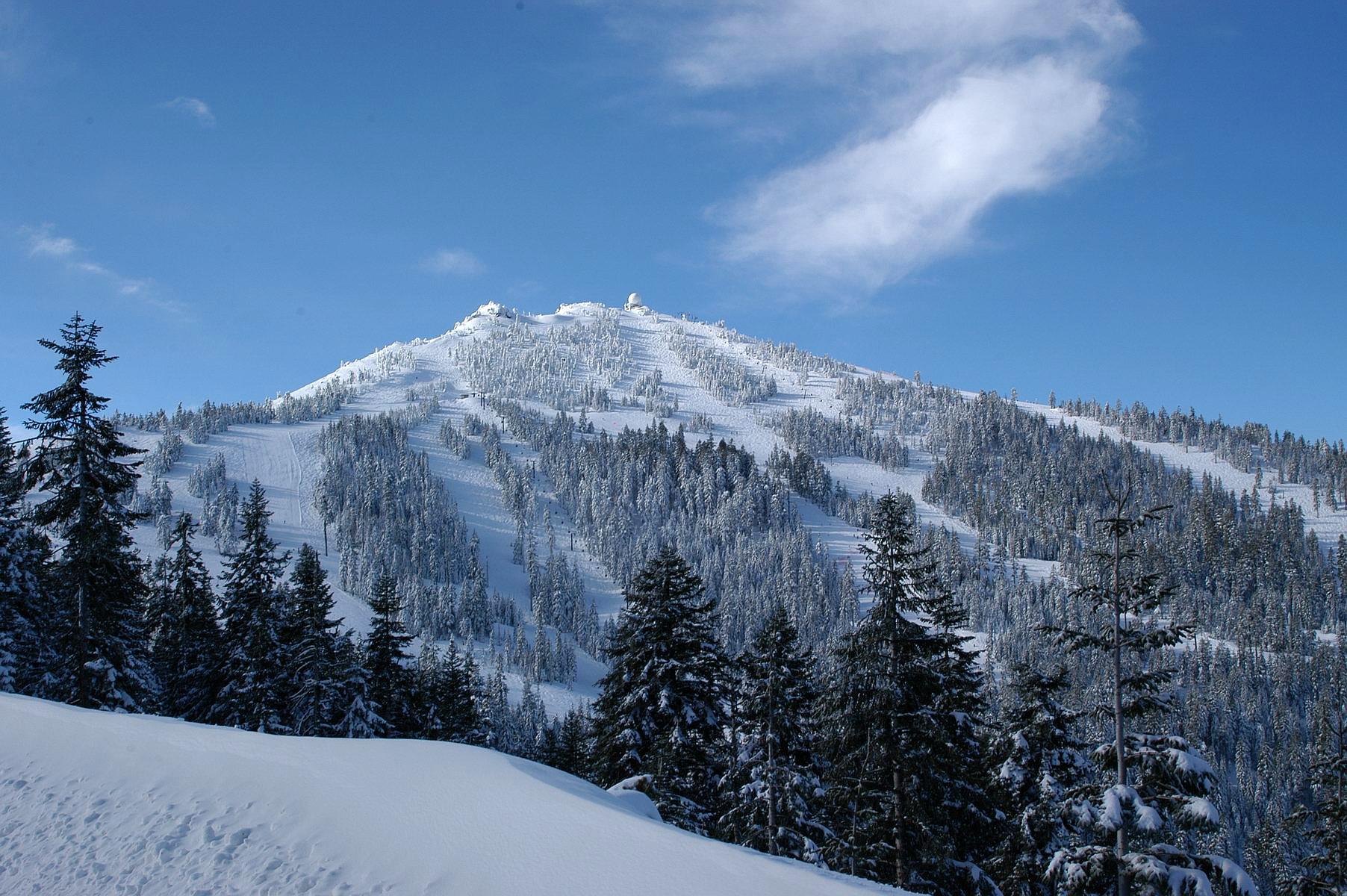
Besonderheiten Höchste Erhebung der Siskiyou Mountains

Mount Ashland ist ein 2.296 Meter hoher Berg im Süden des US-amerikanischen Bundesstaates Oregon mit dem höchsten Gipfel der Siskiyou Mountains. Der Rogue-Siskiyou-Nationalforst umfasst Mount Ashland zum Teil.

Er wurde nach der nahe gelegenen Stadt Ashland im Nordwesten des Berges benannt. Etwa 762 cm Schnee fallen im Winter. Der Berg ist seit den 1950er Jahren ein Wintersportgebiet mit einer Fläche von 80,9 Hektar und im Sommer ein Ziel für Wanderer und Mountainbikefahrer. Der Parkplatz des Skigebiets ist Start- und Zielpunkt des jährlich stattfindenden Siskiyou Out Back Ultramarathons mit einer Länge von 50 Kilometern. Der Fernwanderweg Pacific Crest Trail führt hier an der Süd- und Ostseite vorbei.

Weblinks


Wikimedia Foundation.

Игры ⚽ Нужно сделать НИР?

Schlagen Sie auch in anderen Wörterbüchern nach:

  • Mount Ashland — This article is about Mount Ashland. For the ski area, see Mount Ashland Ski Area. Mount Ashland Mount Ashland ski area in winter …   Wikipedia

  • Mount Ashland Ski Area — Mount Ashland Location Mount Ashland, Oregon Nearest city Ashland, Oregon …   Wikipedia

  • Mount Ashland Ski Area — 42° 05′ 00″ N 122° 43′ 00″ W / 42.08333333, 122.71666667 …   Wikipédia en Français

  • Ashland (Oregon) — Ashland The Plaza Lage von Ashland im Jackson County …   Deutsch Wikipedia

  • Mount Bachelor ski area — Mount Bachelor Pine Marten Express chairlift at Mount Bachelor Location Mount Bachelor Deschutes County Oregon …   Wikipedia

  • Mount Hood Meadows — Location Mount Hood, Oregon Nearest city Government Camp, Oregon …   Wikipedia

  • Ashland, Oregon — Infobox Settlement official name = Ashland, Oregon settlement type = City nickname = motto = imagesize = 250px image caption = The Plaza image image mapsize = 250x200px map caption = mapsize1 = map caption1 = subdivision type = Country… …   Wikipedia

  • Mount Hood Skibowl — Coordinates: 45°18′06″N 121°46′24″W / 45.30180°N 121.77321°W / 45.30180; 121.77321 …   Wikipedia

  • Mount Sterling, Kentucky —   City   Downtown Mount Sterling …   Wikipedia

  • Mount Gilead (Ohio) — Mount Gilead est un village situé dans le comté de Morrow, dans l État de l Ohio, aux États Unis. Le mémorial La population de Mount Gilead s élevait à 3 290 habitants au recensement de l an 2000. Le village est le siège du comté du comté de …   Wikipédia en Français

Share the article and excerpts

Direct link
Do a right-click on the link above
and select “Copy Link”