- Mount Meharry
-
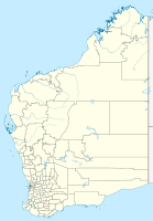
Mount Meharry Höhe 1.251 m Lage Western Australia Gebirge Hamersley Range Geographische Lage 22° 59′ 0″ S, 118° 35′ 0″ O-22.983333333333118.583333333331251Koordinaten: 22° 59′ 0″ S, 118° 35′ 0″ O Besonderheiten höchster Gipfel im Bundesstaat Western Australia Mount Meharry ist mit 1.251 m der höchste Berg im australischen Bundesstaat Western Australia. Er liegt in der Region Pilbara in der Hamersley Range, etwa 135 km von Wittenoom und 160 km von Tom Price entfernt. Er liegt nördlich knapp außerhalb des Karijini National Park.
Quellen
- Mount Meharry bei Peakbagger.com (englisch)
Bimberi Peak (Australian Capital Territory) | Mount Kosciuszko (New South Wales) | Mount Zeil (Northern Territory) | Mount Bartle Frere (Queensland) | Mount Woodroffe (South Australia) | Mount Ossa (Tasmanien) | Mount Bogong (Victoria) | Mount Meharry (Western Australia)
Wikimedia Foundation.


