Hamersley Range

Hamersley Range

p1f1

Hamersley Range
Höchster Gipfel Mount Meharry (1.250 m)
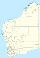
Lage Western Australia
Hamersley Range (Westaustralien)
Hamersley Range
Koordinaten 21° 53′ S, 116° 46′ O-21.883333333333116.766666666671250Koordinaten: 21° 53′ S, 116° 46′ O

Die Hamersley Range ist eine Gebirgsregion in der Region Pilbara im australischen Bundesstaat Western Australia.

Sie erstreckt sich vom Fortescue River im Nordosten 460 km nach Süden. Westaustraliens höchste Erhebung, der 1.250 m hohe Mount Meharry, liegt in dem Gebirgszug.

Das Gebirge ist durch zahlreiche Erosionsschluchten wie der Wittenoom Gorge gekennzeichnet.

Der Karijini-Nationalpark (früher „Hamersley-Nationalpark“), einer von Australiens größten Nationalparks, erstreckt sich um das Gebirge.

Das Gebirge weist reiche Eisenerzlagerstätten auf und ist ein Hauptabbaugebiet in Australien. Entlang des Gebirgszuges sind daher Bergwerke, Bergbausiedlungen und Eisenbahnlinien der großen westaustralischen Bergwerksgesellschaften zu finden.

Literatur

  • Lloyd Marshall: New iron age in the Hamersleys in the Weekend News, 3. September 1966.
  • C. McA Powell et al (1994): Late Archaean and early Proterozoic tectonics and basin formation of the Hamersley Ranges East Perth, W.A. Geological Society of Australia (W.A. Division) "12th Australian Geological Convention, September 1994". Excursion guidebook, 0819-6613 ; no. 4. ISBN 0-909869-90-1

Wikimedia Foundation.

Игры ⚽ Поможем написать курсовую

Schlagen Sie auch in anderen Wörterbüchern nach:

  • Hamersley Range —   [ hæməzlɪ reɪndʒ, englisch], über 250 km langer Gebirgszug in Westaustralien, im Mount Bruce bis 1 235 m über dem Meeresspiegel. Die reichen Eisenerzvorkommen (Bändereisenerze mit 64 % Fe Gehalt, mit sicheren abbauwürdigen Vorräten von über 1… …   Universal-Lexikon

  • Hamersley Range — The Hamersley Range is a mountainous region of the Pilbara, Western Australia. The range runs from the Fortescue River in the northeast, 460km south. The range contains Western Australia s highest point, Mount Meharry, which reaches approximately …   Wikipedia

  • Hamersley Range — ▪ mountains, Western Australia, Australia  mountains in the Pilbara region, northwestern Western Australia, extending east southeast for 160 miles (260 km) south of the Fortescue River. Part of an ancient tableland broken by faults and gorges,… …   Universalium

  • Hamersley Range — /hæməzli ˈreɪndʒ/ (say hamuhzlee raynj) noun a plateau in north western WA, south east of the Fortescue River; iron ore deposits. Highest peak, Mount Meharry, 1253 m …  

  • Hamersley Range National Park — noun → Karijini National Park …  

  • Hamersley — may refer to: * The Hamersley family was a wealthy and well connected family in early colonial Western Australia. Prominent members of the family include: **Edward Hamersley (Snr) **Edward Hamersley (Jnr) **Samuel Hamersley **Vernon Hamersley *… …   Wikipedia

  • Hamersley-Nationalpark — Karijini National Park Östliche Einfahrt …   Deutsch Wikipedia

  • Hamersley National Park — Karijini National Park Östliche Einfahrt …   Deutsch Wikipedia

  • Hamersley family — The Hamersley family were a wealthy and well connected family of early settlers in the colony of Western Australia. Members of the Hamersley family emigrated to Western Australia from England in 1837.Prominent members and connections of the… …   Wikipedia

  • Hamersley — Monts Hamersley Monts Hamersley Géographie Altitude 1 250 m, Mont Meharry …   Wikipédia en Français

Share the article and excerpts

Direct link
Do a right-click on the link above
and select “Copy Link”