Mount Royalist

Mount Royalist

f1

Mount Royalist
Höhe 3.640 m
Lage Viktorialand, Antarktis
Gebirge Admiralitätsberge
Geographische Lage 71° 47′ 0″ S, 168° 30′ 0″ O-71.783333333333168.53640Koordinaten: 71° 47′ 0″ S, 168° 30′ 0″ O
Mount Royalist (Antarktis)
Mount Royalist

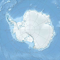
Der Mount Royalist ist ein markanter, 3.640 Meter hoher Berg, der sich drei Kilometer westlich des Mount Adam in den Admiralitätsbergen in Viktorialand erhebt. Benannt wurde er von einer neuseeländischen Antarktisexpedition 1957/58 nach seiner eindrücklichen Erscheinung und nach dem neuseeländischen Kreuzer HMNZS Royalist. In der Umgebung finden sich einige weitere Berge, die nach neuseeländischen Schiffen benannt wurden, etwa den Mount Ajax und den Mount Black Prince.


Wikimedia Foundation.

Игры ⚽ Нужна курсовая?

Schlagen Sie auch in anderen Wörterbüchern nach:

  • Mount Royalist — Infobox Mountain Name = Mount Royalist Photo = Caption = Elevation = 3,640 metres (11,942 feet) Location = Victoria Land, Antarctica Range = Admiralty Mountains Prominence = Coordinates = coord|71|47|S|168|30|E|type:mountain Topographic First… …   Wikipedia

  • Mount Ajax — Bild gesucht  BWf1 Höhe 3.770  …   Deutsch Wikipedia

  • Mount Ajax — Infobox Mountain Name = Mount Ajax Photo = Caption = Elevation = 3,770 metres (12,369 feet) Location = Antarctica Range = Admiralty Mountains Prominence = Coordinates = coord|71|48|S|168|27|E|type:mountain Topographic First ascent = Easiest route …   Wikipedia

  • St Michael's Mount — Infobox UK place static static image caption = St Michael s Mount country = England official name= St Michael s Mount cornish name = Carrack Looz en Cooz latitude= 50.1160 longitude= 5.4772 area total sq mi= 0.09 population density= area… …   Wikipedia

  • Bury Mount — Motte is the remains of an earthwork motte and bailey fortification or ancient castle, and has been designated a Scheduled Ancient Monument. The Motte probably dates back to the 11th Century when it was a Norman fortification but over time has… …   Wikipedia

  • Morgan's Mount — Coordinates: 53°11′36″N 2°53′45″W / 53.19328°N 2.89588°W / 53.19328; 2.89588 …   Wikipedia

  • Admiralty Mountains — Range Mount Herschel (3,335 m) in the Admiralty Mountains as seen from Cape Hallett …   Wikipedia

  • Admiralty Mountains — DMS …   Deutsch Wikipedia

  • Battle of Winceby — The Battle of Winceby took place on 11 October, 1643 during the English Civil War near the village of Winceby, Lincolnshire about 6 km east of Horncastle.Infobox Military Conflict conflict=Battle of Winceby [… …   Wikipedia

  • Dennistoun Glacier — DMS …   Deutsch Wikipedia

Share the article and excerpts

Direct link
Do a right-click on the link above
and select “Copy Link”