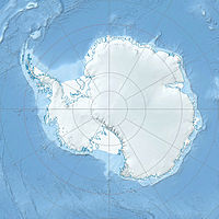
Mount Shattuck — Location of Heritage Range in Western Antarctica. Mount Shattuck (80°26′S 81 … Wikipedia
Shattuck — ist der Nachname folgender Personen: Erasmus D. Shattuck (1824–1900), amerikanischer Politiker und Richter Francis K. Shattuck (1824–1898), amerikanischer Politiker John Shattuck, amerikanischer Politiker Kim Shattuck, amerikanische Sängerin… … Deutsch Wikipedia
Mount Grace State Forest — Massachusetts State Park View from the firetower on Mount Grace Country United States … Wikipedia
Mount Washington State Forest — Massachusetts State Park … Wikipedia
Mount Everett State Reservation — is a state park located in the town of Mount Washington, Massachusetts, USA. The forest is managed by the Department of Conservation and Recreation. Contents 1 Description 2 Recreational opportunities 3 References … Wikipedia
Mount Greylock State Reservation — An October frost on Mount Greylock Mount Greylock State Reservation is a Massachusetts state park that was created in 1898 as Massachusetts first public land for the purpose of forest preservation. It is located on its namesake Mount Greylock … Wikipedia
Mount Tom State Reservation — The Mount Tom State Reservation, 2,082 acres (8.43 km2), encompasses the Mount Tom Range and is located in the Connecticut River Valley region of Massachusetts, just north of the city of Springfield. The reservation is noted for its biologic … Wikipedia
Mount Sugarloaf State Reservation — Observation tower on South Sugarloaf in the fall Sugarloaf Mountain State Reservation, managed by the Massachusetts Department of Conservation and Recreation, is located in Deerfield, Massachusetts, just west of the Connecticut River. The park… … Wikipedia
Mount Holyoke Range State Park — The Mount Hoyoke Range State Park of the Pioneer Valley region of Massachusetts, encompasses the eastern half of the Holyoke Range to traprock mountains. The park is managed by the Massachusetts Department of Conservation and Recreation. The… … Wikipedia
Independence Hills — 80.416666666667 81.55 Koordinaten: 80° 25′ S, 81° 33′ W … Deutsch Wikipedia

