- Ashtabula Township
-
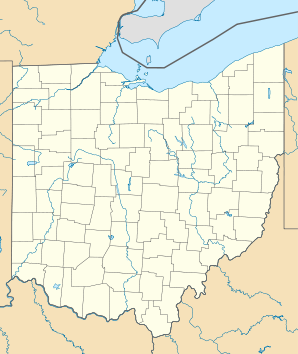
Ashtabula Township Lage in OhioBasisdaten Staat: Vereinigte Staaten Bundesstaat: Ohio County: Koordinaten: 41° 53′ N, 80° 47′ W41.876944444444-80.785277777778177Koordinaten: 41° 53′ N, 80° 47′ W Zeitzone: Eastern Standard Time (UTC−5) Einwohner: 23.239 (Stand: 2000) Bevölkerungsdichte: 446 Einwohner je km² Fläche: 52,6 km² (ca. 20 mi²)
davon 52,1 km² (ca. 20 mi²) LandHöhe: 177 m Postleitzahlen: 44004-44005 Vorwahl: +1 440 FIPS: 39-02652 GNIS-ID: 1085719
Townships des Ashtabula CountysAshtabula Township ist eines von 27 Townships des Ashtabula Countys im US-Bundesstaat Ohio. Nach der Volkszählung im Jahr 2000 waren hier 23.239 Einwohner registriert.[1]
Geografie
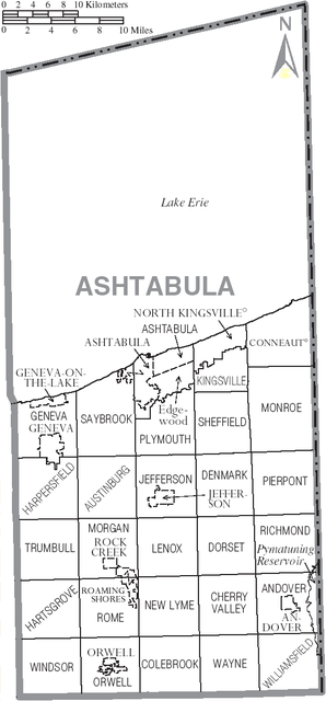
Ashtabula Township liegt im Norden des Ashtabula Countys im äußersten Nordosten von Ohio und grenzt im Norden an den Eriesee und im Uhrzeigersinn an die Townships: Kingsville Township, Plymouth Township und Saybrook Township.
Verwaltung
Das Township wird durch ein Board of Trustees, bestehend aus drei gewählten Mitgliedern, verwaltet. Zwei Personen werden jeweils im Jahr nach der Präsidentschaftswahl gewählt und eine jeweils im Jahr davor. Die Amtszeit dauert in der Regel vier Jahre und beginnt jeweils am 1. Januar. Daneben gibt es noch einen Township Clerk (Schriftführer), der ebenfalls im Jahr vor der Präsidentschaftswahl auf eine vierjährige Amtszeit gewählt wird. Dessen Amtszeit beginnt jeweils am 1. April.
Einzelnachweise
Andover | Astabula | Austinburg | Cherry Valley | Colebrook | Denmark | Dorset | Geneva | Harpersfield | Hartsgrove | Jefferson | Kingsville | Lenox | Monroe | Morgan | New Lyme | Orwell | Pierpont | Plymouth | Richmond | Rome | Saybrook | Sheffield | Trumbull | Wayne | Williamsfield | Windsor
Wikimedia Foundation.
Schlagen Sie auch in anderen Wörterbüchern nach:
Ashtabula Township, Barnes County, North Dakota — Ashtabula Township is a civil township in Barnes County, North Dakota, USA. As of the 2000 census, its population was 93. [cite American Factfinder|twp|3800303580|general|Ashtabula Township] References … Wikipedia
Ashtabula Township, Ashtabula County, Ohio — Infobox Settlement official name = Ashtabula Township, Ohio settlement type = Township nickname = motto = imagesize = image caption = image mapsize = 250x200px map caption = Municipalities and townships of Ashtabula County. mapsize1 = map… … Wikipedia
Ashtabula County — Courthouse in Jefferson, gelistet im NRHP mit der Nr. 75001316[1] Verwaltung … Deutsch Wikipedia
Ashtabula — Luftbild des Hafens von Ashtabula Lage von Ashtabula in Ohio … Deutsch Wikipedia
Ashtabula, Ohio — Infobox Settlement official name = Ashtabula, Ohio settlement type = City nickname = motto = imagesize = 250px image caption = Aerial view of the port at Ashtabula image mapsize = 250px map caption = Location of Ashtabula, Ohio mapsize1 = map… … Wikipedia
Ashtabula River — Verlauf des Ashtabula River Daten Gewäss … Deutsch Wikipedia
Ashtabula River — Infobox River river name = Ashtabula River caption = origin = coord|41|48|51|N|80|36|57|W|region:US OH type:river source:GNISGnis|1065899] Confluence of east and west branches in Monroe Township, Ashtabula County mouth =… … Wikipedia
Ashtabula — /ash teuh byooh leuh/, n. a port in NE Ohio, on Lake Erie. 23,449. * * * ▪ Ohio, United States city, Ashtabula county, northeastern Ohio, U.S. It lies along Lake Erie, at the mouth of the Ashtabula River, about 54 miles (87 km) northeast of … Universalium
Saybrook Township, Ashtabula County, Ohio — Infobox Settlement official name = Saybrook Township, Ashtabula County, Ohio settlement type = Township nickname = motto = imagesize = image caption = image mapsize = 250px map caption = Municipalities and townships of Ashtabula County. mapsize1 … Wikipedia
Kingsville Township, Ashtabula County, Ohio — Infobox Settlement official name = Kingsville Township, Ohio settlement type = Township nickname = motto = imagesize = image caption = image mapsize = 250x200px map caption = Municipalities and townships of Ashtabula County. mapsize1 = map… … Wikipedia