- Pomerape
-
Pomerape 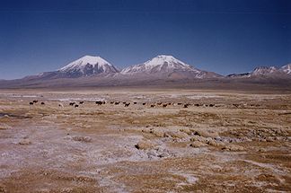
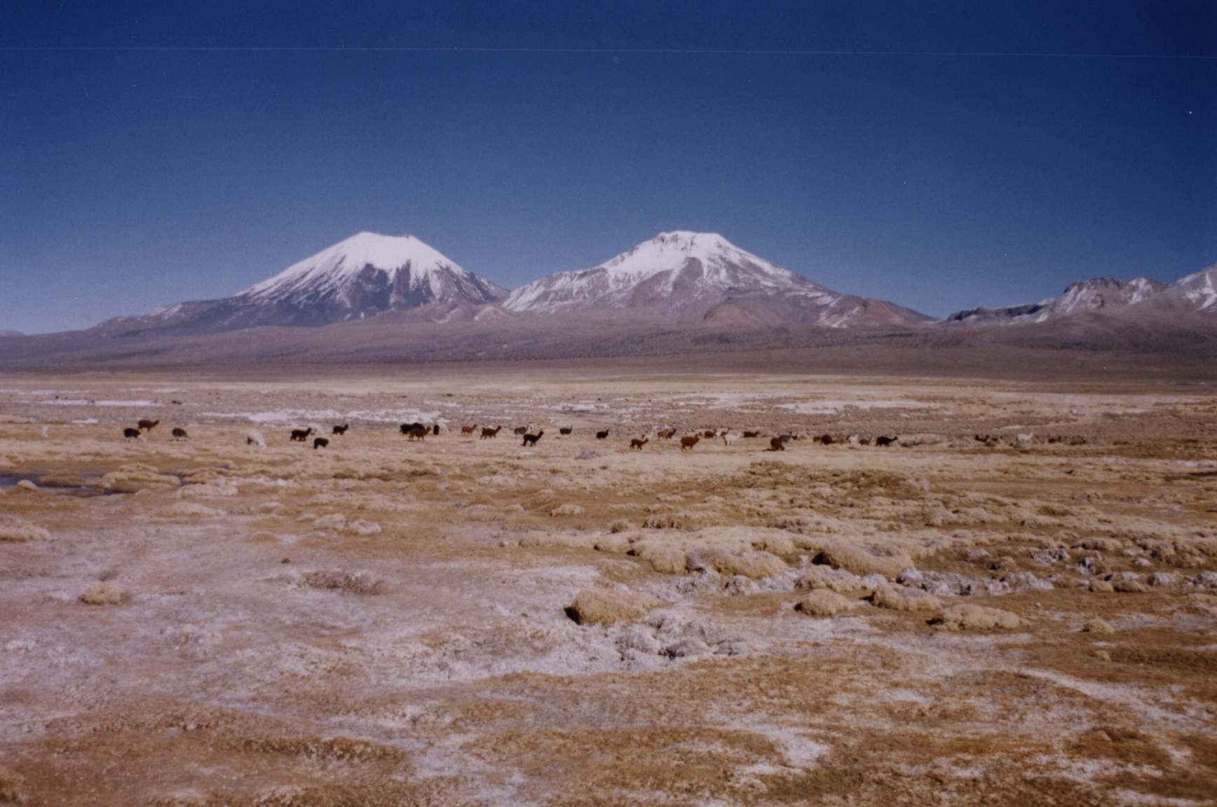
Pomerape (rechts) und Parinacota (links).
Höhe 6.222 m Lage Grenze Chile / Bolivien Gebirge Cordillera Occidental, Anden Dominanz 4 km → Parinacota Schartenhöhe 950 m Geographische Lage 18° 7′ 33″ S, 69° 7′ 39″ W-18.125833333333-69.12756222Koordinaten: 18° 7′ 33″ S, 69° 7′ 39″ W 

Typ Stratovulkan, erloschen Erstbesteigung 14. Mai 1946 durch die Bolivianer Edmundo García und René Zalles Der Pomerape (6.222 m) ist ein erloschener Schichtvulkan an der Grenze zwischen Chile und Bolivien im Gebiet der Atacama-Wüste. Er liegt im Nationalpark Lauca 145 km östlich von Arica in der West-Kordillere der Zentral-Anden. Zusammen mit dem Vulkan Parinacota, der südwestlich von ihm liegt, bildet er den Payachata-Komplex.
Der Gipfel des Pomerape kann relativ einfach als Tagestour von dem unter ihm in 4.200 m Höhe gelegenen Dorf bestiegen werden. Dieses erreicht man entweder von Chile aus Arica (Busverbindung nach La Paz, aber ohne ausreichende Akklimatisation nicht zu empfehlen) oder von La Paz. Man kann sich aus dem Dorf, das nur einfache Übernachtungsmöglichkeiten bietet, bis auf ca. 5.000 m mit dem Geländewagen hinauffahren und auf den Gipfel führen lassen.
Siehe auch
Weblinks
- Pomerape im Global Volcanism Program der Smithsonian Institution (englisch)
- Pomerape auf www.andeshandbook.cl (spanisch)
- Pomerape auf summitpost (englisch)
Kategorien:- Sechstausender
- Schichtvulkan
- Berg in den Anden
- Berg in Südamerika
- Berg in Chile
- Berg in Bolivien
- Departamento Oruro

Wikimedia Foundation.