Quarley Hill

Quarley Hill
Quarley Hill

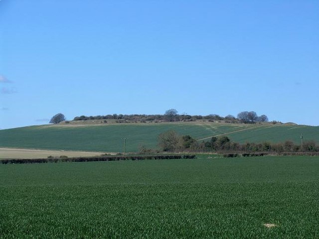
Das ovale Hillfort auf dem 52 Meter hohen Quarley Hill stammt aus der Eisenzeit. Die zweiphasige Anlage liegt nördlich von Grateley in Hampshire im Hügelland zwischen den Orten Amesbury und Andover in England.

Zunächst entstand eine, von einer Palisade umgebene Einhegung. Diese wurde später ergänzt durch einen zwei Meter hohen Wall und einen vier Meter tiefen Graben, mit gestützter Böschung (counterscarp). Der Wall und einer der Zugänge, die sich an der Südwest und Nordostseite befinden, blieben unvollendet. Die Entstehung dieses und dreier weiterer nahe gelegener Hillforts und ihre Beziehungen zueinander und zu den radialen, linearen Erdwällen in ihrer Umgebung wurden von B. Cunliffe untersucht.

Literatur

  • Barry Cunliffe: Before Hillforts In: Oxford Journal of Archaeology Volume 9 Issue 3 S. 323-336, 1990

Quelle

51.178763888889-1.623708333333352

Wikimedia Foundation.

Игры ⚽ Нужна курсовая?

Schlagen Sie auch in anderen Wörterbüchern nach:

  • Chattis Hill — Coordinates: 51°06′55″N 1°32′05″W / 51.115400°N 1.5346849°W / 51.115400; 1.5346849 …   Wikipedia

  • Danebury — Trees around Danebury ring …   Wikipedia

  • List of Sites of Special Scientific Interest in Hampshire — This is a list of the Sites of Special Scientific Interest (SSSIs) in Hampshire. For other counties, see List of SSSIs by Area of Search.* Alresford Pond * Ashford Hill Woods and Meadows * Avon Valley (Bickton to Christchurch) * Baddesley Common… …   Wikipedia

  • Grateley — is a small village in the north west of Hampshire, England.Grateley lies just to the South of the pre historic hillfort of Quarley Hill. The Parish covers 1551 acres with 607 people living in 250 dwellings. The village has two shops, two pubs, a… …   Wikipedia

  • List of places in Hampshire — Location map+|Hampshire caption = Some of the larger settlements of Hampshire. float = right width = 400 places = Location map |Hampshire label = Winchester long = 1.31 lat = 51.06 background = white Location map |Hampshire label = Andover long …   Wikipedia

  • Liste der Orte in Hampshire — Dies ist eine Liste der Orte in der zeremoniellen Grafschaft Hampshire in England. Inhalt Orte A B C D E F G H I J K L M N O P Q R S T U V W X Y …   Deutsch Wikipedia

  • North Baddesley — Coordinates: 50°58′40″N 1°26′15″W / 50.9779°N 1.4375°W / 50.9779; 1.4375 …   Wikipedia

  • Nursling — Coordinates: 50°56′42″N 1°28′22″W / 50.944945°N 1.4726897°W / 50.944945; 1.4726897 …   Wikipedia

  • List of civil parishes in Hampshire — This is a list of civil parishes in Hampshire, England.Basingstoke and DeaneBasingstoke is unparished.*Ashford Hill with Headley *Ashmansworth *Baughurst *Bradley *Bramley *Burghclere *Candovers *Chineham *Cliddesden *Dummer *East Woodhay… …   Wikipedia

  • Michelmersh — Coordinates: 51°02′00″N 1°30′29″W / 51.03323°N 1.50794°W / 51.03323; 1.50794 …   Wikipedia

Share the article and excerpts

Direct link
Do a right-click on the link above
and select “Copy Link”