Ragang

Ragang
Ragang

Photo-request.svg

Bild gesucht 

BWf1

Höhe 2.815 m
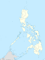
Lage Insel Mindanao, Philippinen
Geographische Lage 7° 41′ 30″ N, 124° 30′ 28″ O7.6916666666667124.507777777782815Koordinaten: 7° 41′ 30″ N, 124° 30′ 28″ O
Ragang (Philippinen)
Ragang
Typ Stratovulkan
Letzte Eruption 1873, 1916

Der Vulkan Ragang ist ein Stratovulkan auf der philippinischen Insel Mindanao. Er liegt an der Grenze zwischen den Provinzen Lanao del Sur und Cotabato in der Autonomous Region in Muslim Mindanao. Der Ragang ist einer von 22 aktiven Vulkanen auf den Philippinen und der aktivste Vulkan auf Mindanao. Er gehört zu einer Vulkankette, die von Vulkanologen Central Mindanao Arc (ein Teil des philippinischen Inselbogens) genannt wird, in dem sich auch der Latukan und der Mount Apo befindet.

Der Gipfel liegt 2815 m über dem Meeresspiegel, der Berg hat einen Basisdurchmesser von 32 km.

Ausbrüche

Über die Zahl der Ausbrüche gibt es widersprüchliche Angaben. Das Philippine Institute of Volcanology and Seismology nennt acht Eruptionen und datiert die jüngste Eruption auf den Juli 1916. Das Smithsonian Institution's Global Volcanology Program geht davon aus, dass einige Ausbrüche des benachbarten Makaturing dem Ragang zuzurechnen sind und datiert den jüngsten Ausbruch auf 1873.

Quellen

Weblinks


Wikimedia Foundation.

Игры ⚽ Нужна курсовая?

Schlagen Sie auch in anderen Wörterbüchern nach:

  • Ragang — Original name in latin Ragang Name in other language Ragang State code ID Continent/City Asia/Jakarta longitude 8.0505 latitude 113.8295 altitude 338 Population 0 Date 2012 01 21 …   Cities with a population over 1000 database

  • rågång — s ( en, ar) …   Clue 9 Svensk Ordbok

  • Mount Ragang — Mount Ragang …   Wikipedia

  • Nunuk Ragang — Coordinates: 5°43′N 116°51′E / 5.717°N 116.85°E / 5.717; 116.85 Nunuk Ragang is a legendary red banyan tree t …   Wikipedia

  • List of Malaysia-related topics — This is a list of topics related to Malaysia.Buildings and structures in Malaysia* Angkasapuri * Berjaya Times Square * Chin Swee Temple * Connaught Bridge Power Station * Kellie s Castle * Kelong * Kota Ngah Ibrahim * Malay houses * Malaysian… …   Wikipedia

  • Mindanao — Coordinates: 8°00′N 125°00′E / 8°N 125°E / 8; 125 …   Wikipedia

  • Mount Apo — The Grandfather of Philippine Mountains Elevation 2,954 m (9,692 ft)  …   Wikipedia

  • Mount Pulag — Elevation 2,922 m (9,587 ft) [1] …   Wikipedia

  • Kadazan — ethnic group group=Kadazan poptime= popplace= flagicon|MalaysiaMalaysia: Sabah langs=Kadazan, Malay, English rels=Christianity, Islam, Animism related=Dusun, other Austronesian peoplesThe Kadazans are an ethnic group indigenous to the state of… …   Wikipedia

  • Kadazan-Dusun — is the term assigned to the unification of the classification of two indigenous tribes in Sabah, Malaysia mdash;the ethnic groups Kadazan and Dusun. History The designation is officially recognised as the result of political machinations,… …   Wikipedia

Share the article and excerpts

Direct link
Do a right-click on the link above
and select “Copy Link”