- Rossendale
-
Borough of Rossendale
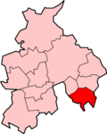
Lage in LancashireStatus Borough Region North West England Verw.grafschaft Lancashire Verwaltungssitz Rawtenstall Fläche 138,05 km² (218.) Einwohner 67.000 (318.) ONS-Code 30UM Website www.rossendale.gov.uk Rossendale ist ein Verwaltungsbezirk mit dem Status eines Borough in der Grafschaft Lancashire in England. Verwaltungssitz ist die Stadt Rawtenstall. Weitere bedeutende Orte sind Bacup, Edenfield, Haslingden, Ramsbottom und Whitworth. Es besteht eine Städtepartnerschaft mit Bocholt in Deutschland.
Der Bezirk wurde am 1. April 1974 gebildet und entstand aus der Fusion der Boroughs Bacup, Haslingden und Rawtenstall, des Urban District Whitworth sowie von Teilen des Urban District Ramsbottom.
Burnley | Chorley | Fylde | Hyndburn | Lancaster | Pendle | Preston | Ribble Valley | Rossendale | South Ribble | West Lancashire | Wyre
Wikimedia Foundation.
Schlagen Sie auch in anderen Wörterbüchern nach:
Rossendale — Infobox UK District name = Borough of Rossendale status = Borough region = North West England admincounty = Lancashire area = Ranked 218th 138.05 km² adminhq = Rawtenstall onscode = 30UM population = Ranked English district rank|ONS=30UM English… … Wikipedia
Rossendale — 53°41′00″N 02°15′00″O / 53.683333, 2.25 … Wikipédia en Français
Rossendale — Original name in latin Rossendale Name in other language Borough of Rossendale, Rossendale, Rossendale District State code GB Continent/City Europe/London longitude 53.68456 latitude 2.2769 altitude 380 Population 67400 Date 2012 06 01 … Cities with a population over 1000 database
Rossendale — ▪ district, England, United Kingdom borough (district), administrative and historic county of Lancashire, England. It lies immediately north of Greater Manchester, in the ancient Forest of Rossendale, from which it takes its name. The River … Universalium
Rossendale Borough Council — is a local authority district council in the Lancashire area of north west England.It was formed on 1st April 1974 as a result of the 1972 Local Government Act and consists of:* The former Municipal Boroughs of Bacup, Haslingden Rawtenstall * One … Wikipedia
Rossendale School — is a specialist residential and day school for girls and boys aged eight to 16 with behavioural, emotional and social difficulties. The school was founded in 1989 and is located in Ramsbottom, Lancashire, England. The schools headtecher is called … Wikipedia
Rossendale Transport — Infobox Bus transit name = Rossendale Transport Easyride Buses logo size = 180 image caption = A Rossendale Transport EASYRIDE fully accessible bus founded = 1907 headquarters = Knowsley Park Way, Haslingden, Lancashire. BB4 4RS service area = UK … Wikipedia
Rossendale United F.C. — Football club infobox clubname = Rossendale United fullname = Rossendale United Football Club nickname = The Stags founded = c. 1898 ground = Dark Lane, Newchurch, Lancashire | capacity = 2,500 chairman = flagicon|England Steve Hobson mgrtitle =… … Wikipedia
Rossendale local elections — One third of Rossendale Council in Lancashire, England is elected each year, followed by one year where there is an election to Lancashire County Council instead.Political controlNo overall control 1973 1976Conservative 1976 1986Labour 1986… … Wikipedia
Rossendale Council election, 2008 — Elections to Rossendale Council were held on 1 May, 2008. One third of the council was up for election and the Conservative party gained overall control of the council from no overall control.cite web| url =… … Wikipedia