- Rowlesburg
-
Rowlesburg 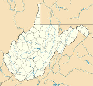

Rowlesburg Lage in West VirginiaBasisdaten Staat: Vereinigte Staaten Bundesstaat: West Virginia County: Koordinaten: 39° 21′ N, 79° 40′ W39.35-79.672777777778422Koordinaten: 39° 21′ N, 79° 40′ W Zeitzone: Eastern Standard Time (UTC−5) Einwohner: 613 (Stand: 2000) Bevölkerungsdichte: 227 Einwohner je km² Fläche: 3,0 km² (ca. 1 mi²)
davon 2,7 km² (ca. 1 mi²) LandHöhe: 422 m Postleitzahl: 26425 Vorwahl: +1 304 FIPS: 54-70588 GNIS-ID: 1552749 Webpräsenz: www.rowlesburg.org Rowlesburg ist eine Stadt im Preston County im US-Bundesstaat West Virginia. Rowlesburg hat 613 Einwohner auf einer Fläche von 3 km². Die Stadt liegt am Cheat River und wird von der West Virginia State Route 72 tangiert.
Kategorie:- Ort in West Virginia

Wikimedia Foundation.