- Semichi Islands
-
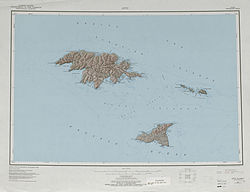
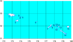
Semichi Islands Topographisches Kartenblatt Gewässer Pazifischer Ozean Archipel Alëuten Geographische Lage 52° 44′ N, 174° 1′ O52.733333333333174.01666666667Koordinaten: 52° 44′ N, 174° 1′ O Anzahl der Inseln 5 (+ zahlreiche Felseilande) Hauptinsel Shemya Island Gesamtfläche 26 km² Einwohner 27 Karte der West-Aleuten/ Semichi Islands: 3 - Alaid, 4 - Nizki, 5 - Shemya Die Semichi Islands bilden eine Inselgruppe innerhalb der Alëuten am Südrand des nordpazifischen Beringmeers.
Geographie
Die zu Alaska (USA) gehörende Inselgruppe liegt südöstlich von Attu und nordöstlich von Agattu Island, mit denen sie gemeinsam die Inselgruppe der Near Islands bilden. Zu den benannten Inseln der Gruppe gehören von Westen nach Osten, Alaid Island, Nizki Island, Hammerhead Island, Lotus Island und Shemya Island.
Tierwelt
Nachdem der Seeotter hier seit mehr als hundert Jahren ausgerottet war, ist er zu Beginn der 1990er auf die Semichi Islands zurückgekehrt. 1994 wurden hier etwa 400 Tiere gezählt, 1997 nur noch 100.
Weblinks
Inseln der Near IslandsAgattu | Alaid | Attu | Cooper Islands | Gibson Islands | Hammerhead | Hodikof | Kennon | Kohl | Loaf | Lotus | Nizki | Peaked | Savage | Semichi Islands | Shemya
Wikimedia Foundation.
Schlagen Sie auch in anderen Wörterbüchern nach:
Semichi Islands — The Semichi Islands (Samiyan [Bergsland, K Aleut Dictionary Fairbanks: Alaska Native Language Center, 1994] in Aleut) are a cluster of small islands in the Near Islands group of the Aleutian Islands, Alaska. They are located southeast of Attu… … Wikipedia
Islas Semichi — (Semichi Islands) Vista de la isla Shemya Localización geográfica / administrativa … Wikipedia Español
Near Islands — Native name: Sasignan tanangin … Wikipedia
List of islands of Alaska — This is an incomplete list of islands in the U.S. state of Alaska. There are about 2,670 named islands in the state.Cref|A [Cite web title=Alaska Office of Economic Development publisher=Alaska Department of Commerce, Community and Economic… … Wikipedia
List of Aleutian Islands — Major groups in the Aleutian Islands are listed from east to west, and islands within each group are listed alphabetically. The Aleut names are given in brackets. =Fox Islands= *Aiktak Island (Ugangax) *Akun Island (Akungan) *Akutan Island… … Wikipedia
Near Islands — Karte der Near Islands Gewässer Nordpazifik Archipel … Deutsch Wikipedia
Near Islands — Géographie Pays États Unis Archipel Îles Aléoutiennes Localisati … Wikipédia en Français
Cooper Islands — Karte vom Nordosten von Attu Die Cooper Islands sind eine kleine Inselgruppe in der Mündung des Chicago Harbor auf der Nordost Seite von Attu, der größten Insel der Near Islands in den Aleuten. Die Inseln wurden im Juli 1855 bei der North Pacific … Deutsch Wikipedia
Gibson Islands — Karte vom Nordosten von Attu Die Gibson Islands sind eine kleine Inselgruppe in der Mündung des Chichagof Harbor auf der Nordost Seite von Attu, der größten Insel der Near Islands in den Aleuten. Die Inseln wurden im Juli 1855 bei der North… … Deutsch Wikipedia
Nizki — Vorlage:Infobox Insel/Wartung/Bild fehltVorlage:Infobox Insel/Wartung/Fläche fehlt Nizki Island Gewässer Pazifischer Ozean Inselgruppe Semichi Islands Geographische Lage … Deutsch Wikipedia