Toetoes Bay

Toetoes Bay
-46.587777777778168.73027777778
Toetoes Bay (Neuseeland)
Toetoes Bay
Toetoes Bay

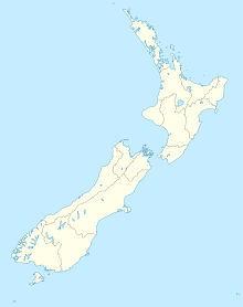
Die Toetoes Bay ist die östlichste von drei großen Buchten an der Küste der Foveaux-Straße in der neuseeländischen Region Southland, die anderen zwei sind die Te Waewae Bay und Oreti Beach.

Die Bucht ist 20 Kilometer lang und bildet das Südende der Awarua Plain, eines sumpfigen Gebietes, das sich etwa 15 Kilometer landeinwärts erstreckt. Das Ostende der Bucht befindet sich nahe Slope Point dem südlichsten Punkt der Südinsel und Anfangspunkt der Catlins.

Tiwai Point mit seiner Aluminiumhütte liegt auf einer Halbinsel am Westende der Bucht am Rand von Bluff Harbour. Die Lagune Waituna Lagoon liegt auf halbem Wege an der Bucht. In der Nähe ihres Ostendes mündet der Mataura River in die Foveaux-Straße. Unmittelbar vor der Mündung durchfließt er eine weitere Lagune, Totoes Harbour, an der der Ort Fortrose liegt.


Wikimedia Foundation.

Игры ⚽ Поможем сделать НИР

Schlagen Sie auch in anderen Wörterbüchern nach:

  • Toetoes Bay — is the easternmost of three large bays lying on the Foveaux Strait coast of Southland, New Zealand, the others being Te Waewae Bay and Oreti Beach. Thirty kilometres (20 miles) in length, the bay is the southern end of the Awarua Plain, an area… …   Wikipedia

  • Te Waewae Bay — is the westernmost of three large bays lying on the Foveaux Strait coast of Southland, New Zealand, the others being Oreti Beach and Toetoes Bay. Twenty seven kilometres in length, the western end of the bay is mountainous, with the southern… …   Wikipedia

  • Te Waewae Bay — 46.25167.5 Koordinaten: 46° 15′ S, 167° 30′ O …   Deutsch Wikipedia

  • Catlins — The Catlins (manchmal auch The Catlins Coast) ist ein Gebiet im Südwesten der Südinsel Neuseelands zwischen Balclutha und Invercargill. Es streift die Grenze zwischen den Regionen Otago und Southland und umfasst auch den südlichsten Punkt der… …   Deutsch Wikipedia

  • The Catlins — (sometimes referred to as The Catlins Coast) comprises an area in the southeastern corner of the South Island of New Zealand. The area lies between Balclutha and Invercargill, straddling the boundary between the Otago and Southland regions. It… …   Wikipedia

  • The Catlins — (manchmal auch The Catlins Coast) ist ein Gebiet im Südwesten der Südinsel Neuseelands zwischen Balclutha und Invercargill. Es streift die Grenze zwischen den Regionen Otago und Southland und umfasst auch den südlichsten Punkt der Südinsel, Slope …   Deutsch Wikipedia

  • Mataura River — Origin Mountains to the south of Lake Wakatipu Mouth Toetoes Bay Basin countries New Zealand Length 190 kilometres (120 mi) Mouth el …   Wikipedia

  • Foveaux-Straße — Übersichtskarte der Straße Die Foveaux Straße (engl. Foveaux Strait) ist eine Meerenge in Neuseeland. Ihre Nordseite wird von der Südküste der Neuseeländischen Südinsel, die hier drei große Buchten, Te Waewae Bay, Oreti Beach und Toetoes Bay hat …   Deutsch Wikipedia

  • Foveaux Strait — Übersichtskarte der Straße Die Foveaux Straße (engl. Foveaux Strait) ist eine Meerenge in Neuseeland. Ihre Nordseite wird von der Südküste der Neuseeländischen Südinsel, die hier drei große Buchten, Te Waewae Bay, Oreti Beach und Toetoes Bay hat …   Deutsch Wikipedia

  • Foveauxstraße — Foveaux Strait Stewart Island/Rakiura und Foveaux Strait vom Bluff Hill aus gesehen. Die Foveaux Strait befindet sich mitten in …   Deutsch Wikipedia

Share the article and excerpts

Direct link
Do a right-click on the link above
and select “Copy Link”