- Thanet (District)
-
Thanet District 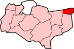
Lage in KentStatus District Region South East England Verw.grafschaft Kent Verwaltungssitz Margate Fläche 103,30 km² (241.) Einwohner 129.200 (152.) ONS-Code 29UN Website www.thanet.gov.uk Thanet ist ein District in der Grafschaft Kent in England. Er umfasst ein Gebiet an der Themse-Mündung, das als Isle of Thanet bekannt ist. Verwaltungssitz ist Margate; weitere bedeutende Orte sind Birchington-on-Sea, Broadstairs, Manston, Ramsgate und Westgate-on-Sea.
Der Bezirk wurde am 1. April 1974 gebildet und entstand aus der Fusion der Municipal Boroughs Margate und Ramsgate, des Urban District Broadstairs and St Peter's und eines Teils des Rural District Eastry.

Ashford | Canterbury | Dartford | Dover | Gravesham | Maidstone | Sevenoaks | Shepway | Swale | Thanet | Tonbridge and Malling | Tunbridge Wells

Wikimedia Foundation.