Banggi

Banggi

Vorlage:Infobox Insel/Wartung/Bild fehlt

Banggi
Gewässer Südchinesisches Meer, Sulusee
Geographische Lage 7° 15′ 0″ N, 117° 10′ 0″ O7.25117.16666666667529Koordinaten: 7° 15′ 0″ N, 117° 10′ 0″ O
Banggi (Malaysia)
Banggi
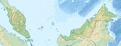
Fläche 441 km²
Höchste Erhebung 529 m
Einwohner 20.000
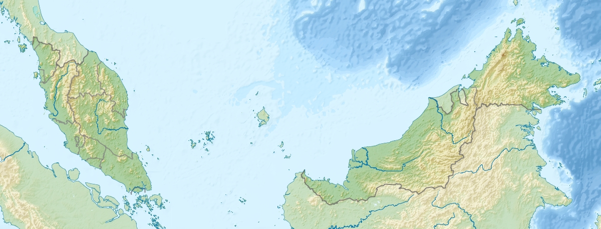
45 Einw./km²

Banggi (malaiisch: Pulau Banggi, manchmal auch Bangi) ist die größte Insel Malaysias. Sie liegt vor der Nordspitze Borneos und gehört zum Bundesstaat Sabah, (Division Kudat).

Banggi hat eine Fläche von 441 km² und etwa 20.000 Einwohner, die höchste Erhebung mißt 529 m. An der Südspitze der Insel befindet sich die kleine Stadt Karakit mit Gesundheitszentrum, Moschee und einem Büro der Forstverwaltung. Ungefähr 24 ha der Insel wurden 1984 zum Schutzgebiet erklärt (Class V I Virgin Jungle Reserve, VJR) [1].

Im Südosten liegen eine Vielzahl weiterer kleiner Inselchen. 5 km im Westen liegt die Insel Balambangan, 15 km im Südosten Malawali.

Banggi liegt am Übergang vom westlich von ihr gelegenen Südchinesischen Meer zur Sulusee im Osten und wird im Norden durch die beide Meere verbindenden Balabacstraße von der philippinischen Insel Balabac getrennt.

Einzelnachweise

  1. http://www.forest.sabah.gov.my/caims/Class%20VI/A_FR6/Karakit.htm

Weblinks


Wikimedia Foundation.

Игры ⚽ Нужно сделать НИР?

Schlagen Sie auch in anderen Wörterbüchern nach:

  • Banggi — Original name in latin Banggi Name in other language Banggi State code ID Continent/City Asia/Jakarta longitude 6.7468 latitude 111.2908 altitude 28 Population 0 Date 2012 01 22 …   Cities with a population over 1000 database

  • Banggi Island — is located within the Kudat Division of Sabah in Malaysia. With an area of 440.7 square kilometres it is the largest island in Malaysia followed by Betruit Island, Langkawi Island and Penang Island. It is located off the northern coast of Sabah,… …   Wikipedia

  • Isla Banggi — Pulau Banggi Localización País  Malasia Estado …   Wikipedia Español

  • Geography of Malaysia — Continent Asia Region Southeast Asia Coordinates 2°30 N 112°30 E Area Ranked 67th 329,847 km2 …   Wikipedia

  • LVN Pictures — LVN Pictures, Inc. is one of the biggest film studios in the history of Philippine cinema and its foremost establishment in motion picture post production until 2005. In its heyday of motion picture production, LVN Pictures has been compared to… …   Wikipedia

  • Mabul — is an island off the south eastern coast of Sabah in Malaysia. It first became popular due to its proximity to Sipadan island. Few years back, it has gained its recognition as one of the best muck diving sites in the world. Mabul island is a… …   Wikipedia

  • Potenciano Gregorio — Potenciano Gregorio, often referred to as Potenciano Gregorio, Sr. (May 19, 1880 to February 12, 1939) was a Bicolano musician. He was the composer of Sarung Banggi (One Evening), the most famous song in the Bikol language.Potenciano Gregorio was …   Wikipedia

  • Malawali Island — Malawali is an island in the state of Sabah, Malaysia located in the Sulu Sea. It is located within the Kudat Division, and sits nearby the islands of Banggi and Balambangan. The island is surrounded by coral reefs and is one of the popular… …   Wikipedia

  • As-sabah — Sabah Flagge Wappen …   Deutsch Wikipedia

  • Balabacstraße — Verbindet Gewässer Südchinesisches Meer mit Gewässer Sulusee Trennt Landmasse Balabac (Philippinen) von Landmasse Banggi (Malaysia) …   Deutsch Wikipedia

Share the article and excerpts

Direct link
Do a right-click on the link above
and select “Copy Link”