Tiszanagyfalu

Tiszanagyfalu
Tiszanagyfalu
Wappen von Tiszanagyfalu
Tiszanagyfalu (Ungarn)
Paris plan pointer b jms.svg
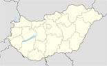
Basisdaten
Staat: Ungarn
Region: Észak-Alföld (Nördliche Große Tiefebene)
Komitat: Szabolcs-Szatmár-Bereg
Kleingebiet: Tiszavasvári
Koordinaten: 48° 5′ N, 21° 28′ O48.09149321.47204Koordinaten: 48° 5′ 29″ N, 21° 28′ 19″ O
Fläche: 27,05 km²
Einwohner: 1.904 (1. Jän. 2010)
Bevölkerungsdichte: 70 Einwohner je km²
Telefonvorwahl: (+36) 42
Postleitzahl: 4463
KSH kódja: 27252
Struktur und Verwaltung
Gemeindeart: Dorf
Bürgermeister: László Kemecsei
Postanschrift: Kossuth út 43.
4463 Tiszanagyfalu
Webpräsenz:

Tiszanagyfalu ist ein Dorf im Osten des ungarischen Komitats Szabolcs-Szatmár-Bereg im Nordosten Ungarns. Es liegt am toten Arm des Morotva-Sees, 25 km von Nyíregyháza, 3 km von Rakamaz und 10 km von Tokaj entfernt


Wikimedia Foundation.

Игры ⚽ Поможем написать курсовую

Schlagen Sie auch in anderen Wörterbüchern nach:

  • Tiszanagyfalu — Administration …   Wikipédia en Français

  • Tiszanagyfalu — Infobox Settlement settlement type = subdivision type = Country subdivision name = HUN latd= |latm= |lats= |latNS=N longd= |longm= |longs= |longEW=Epushpin pushpin label position = pushpin map caption = pushpin mapsize = timezone=CET utc… …   Wikipedia

  • Tiszanagyfalu — Original name in latin Tiszanagyfalu Name in other language Tiszanagyfalu State code HU Continent/City Europe/Budapest longitude 48.1 latitude 21.48333 altitude 96 Population 2010 Date 2012 01 18 …   Cities with a population over 1000 database

  • Kleingebiet Tiszavasvari — Koordinaten fehlen! Hilf mit. Das Kleingebiet Tiszavasvári (ungarisch Tiszavasvári kistérség) ist eine ungarische Verwaltungseinheit (LAU 1) innerhalb des Komitat Szabolcs Szatmár Bereg in Ostungarn. Der Verwaltungssitz ist Tiszavasvári.… …   Deutsch Wikipedia

  • Nyíregyháza — City center …   Wikipedia

  • Szabolcs-Szatmár-Bereg County — Infobox Hungarian county name =Szabolcs Szatmár Bereg region =Northern Great Plain seat = Nyíregyháza area = 5936 population = 572,423 density = 96 cities = 228Szabolcs Szatmár Bereg is an administrative county (Hungarian: megye ) in north… …   Wikipedia

  • Máriapócs — Country  Hungary County Szabolcs Szatmár Bereg Area    Total 22.09 km2 (8 …   Wikipedia

  • Nagykálló — Country  Hungary County Szabolcs Szatmár Bereg Area  – Total 68.55 km2 (26 …   Wikipedia

  • Nyírtass — Country  Hungary County Szabolcs Szatmár Bereg Area    Total 37.95 km2 (14 …   Wikipedia

  • Baktalórántháza —   Market Town   Aerial photograph: Baktalórántháza Palace …   Wikipedia

Share the article and excerpts

Direct link
Do a right-click on the link above
and select “Copy Link”